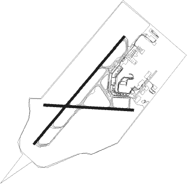
Quebec - Quebec Jean Lesage Intl
Airport details
| Country | Canada |
| State | Quebec |
| Region | CY |
| Airspace | Montreal Ctr |
| Elevation | 244ft (74m) |
| Timezone | GMT -5 |
| Coordinates | 46.78818, -71.37671 |
| Magnetic var | |
| Type | land |
| Available since | X-Plane v10.40 |
| ICAO code | CYQB |
| IATA code | YQB |
| FAA code | n/a |
Communication
| Quebec Jean Lesage Intl ATIS Eng | 134.600 |
| Quebec Jean Lesage Intl ATIS Fr | 128.300 |
| Quebec Jean Lesage Intl Ground Control | 121.900 |
| Quebec Jean Lesage Intl Tower | 118.650 |
| Quebec Jean Lesage Intl TRML CON | 124.000 |
| Quebec Jean Lesage Intl TRML CON | 127.850 |
Approach frequencies
| ILS-cat-I | RW06 | 109.5 | 18.00mi |
| 3° GS | RW06 | 109.5 | 18.00mi |
Nearby Points of Interest:
maison Routhier
-Cimetiere de Cap-Rouge
-Fort Charlesbourg Royal
-site archéologique Cartier-Roberval
-Parc de la Visitation
-Bibliothèque Monique-Corriveau
-Quebec Bridge
-église Saint-Thomas-d'Aquin
-maison Gomin
-Villa Bagatelle
-Sillery Heritage Site
-Saint-Nicolas Heritage Site
-Hôpital-Général de Québec
-Moulin à vent de l'Hôpital-Général-de-Québec
-Église Saint-Charles-Borromée (Charlesbourg)
-Quebec City Martello Towers
-Édifice André-Laurendeau
-Quebec City Armoury
-Capitole de Québec
-Les Nouvelles-Casernes
-Old Quebec
-Sewell House
-Morrin Centre
-Édifice Price
-City Hall of Quebec City

Nearby beacons
| code | identifier | dist | bearing | frequency |
|---|---|---|---|---|
| QB | QUEBEC NDB | 4.2 | 246° | 230 |
| BV | CHAMPLAIN (QUEBEC) NDB | 6.3 | 49° | 336 |
| YQB | QUEBEC VORTAC | 11.4 | 252° | 112.80 |
| VLV | DME | 56.3 | 148° | 117.20 |
Departure and arrival routes
| Transition altitude | 18000ft |
| Transition level | 18000ft |
| SID end points | distance | outbound heading | |
|---|---|---|---|
| RW06 | |||
| SEBIP1 | 31mi | 211° | |
| RW24 | |||
| GOXEV1 | 36mi | 288° | |
| RW29 | |||
| TILAC1 | 36mi | 288° | |
| STAR starting points | distance | inbound heading | |
|---|---|---|---|
| RW06 | |||
| PESAC4 | 28.2 | 73° | |
| OLAVO4 | 23.2 | 101° | |
| KAROT6 | 19.8 | 197° | |
| SIMTO4 | 27.6 | 244° | |
| OMVAR1 | 19.2 | 350° | |
| RW11 | |||
| PESAC4 | 28.2 | 73° | |
| OLAVO4 | 23.2 | 101° | |
| KAROT6 | 19.8 | 197° | |
| SIMTO4 | 27.6 | 244° | |
| OMVAR1 | 19.2 | 350° | |
| RW24 | |||
| PESAC4 | 28.2 | 73° | |
| OLAVO4 | 23.2 | 101° | |
| KAROT6 | 19.8 | 197° | |
| SIMTO4 | 27.6 | 244° | |
| OMVAR1 | 19.2 | 350° | |
| RW29 | |||
| PESAC4 | 28.2 | 73° | |
| OLAVO4 | 23.2 | 101° | |
| KAROT6 | 19.8 | 197° | |
| SIMTO4 | 27.6 | 244° | |
| OMVAR1 | 19.2 | 350° | |
Instrument approach procedures
| runway | airway (heading) | route (dist, bearing) |
|---|---|---|
| RW06-Y | AXANU (117°) | AXANU 5000ft LOGDU (4mi, 235°) 3600ft KEDIV (4mi, 161°) 2300ft TOTUX (2mi, 81°) 1600ft |
| RW06-Y | DEDGO (17°) | DEDGO 5000ft VOBIM (9mi, 342°) 2300ft TOTUX (2mi, 22°) 1600ft |
| RW06-Y | EBLAP (324°) | EBLAP 5000ft VIXIS (4mi, 235°) 3900ft VOBIM (4mi, 281°) 2300ft TOTUX (2mi, 22°) 1600ft |
| RW06-Y | IKBUS (89°) | IKBUS 5000ft KEDIV (11mi, 103°) 2300ft TOTUX (2mi, 81°) 1600ft |
| RW06-Y | KAVAT (58°) | KAVAT 3000ft TOTUX (7mi, 55°) 1600ft |
| RNAV | TOTUX 1600ft CYQB (5mi, 61°) 295ft IKDEB (12mi, 53°) 4000ft IKDEB (turn) | |
| RW06-Z | RAGUP (76°) | RAGUP 3000ft KAVAT (5mi, 124°) 3000ft |
| RW06-Z | USBUR (33°) | USBUR 3000ft KAVAT (5mi, 304°) 3000ft |
| RNAV | KAVAT 3000ft TOTUX (7mi, 55°) 1600ft URTAT (3mi, 55°) 740ft CYQB (3mi, 67°) 295ft IKDEB (12mi, 53°) 4000ft IKDEB (turn) | |
| RW11-Y | OMADU (72°) | OMADU 5000ft MUTOS (5mi, 68°) 3300ft MUPKO (5mi, 59°) 1700ft |
| RW11-Y | RIDUT (19°) | RIDUT 5000ft IKLIV (8mi, 324°) 2700ft MUPKO (3mi, 16°) 1700ft |
| RNAV | MUPKO 1700ft ELINI (2mi, 78°) 1000ft CYQB (3mi, 94°) 289ft MAXOG (10mi, 96°) 3000ft MAXOG (turn) | |
| RW11-Z | LOPGU (95°) | LOPGU IMOVA (7mi, 118°) 3500ft |
| RW11-Z | PIBNI (73°) | PIBNI IMOVA (6mi, 28°) 3500ft |
| RNAV | IMOVA 3500ft KASOT (3mi, 85°) 3150ft ALVUD (4mi, 85°) 2000ft IPVAR (2mi, 85°) 1310ft DUNUD (1mi, 85°) 830ft DUKBA (1mi, 85°) 442ft (4648mi, 123°) 800ft AVISO (4635mi, 303°) 3000ft AVISO (turn) | |
| RW24-Y | IKDEB (233°) | IKDEB 4000ft TEFBY (5mi, 235°) 2600ft URVAK (4mi, 235°) 1500ft |
| RW24-Y | PIKVO (117°) | PIKVO 5000ft MIVAG (5mi, 55°) 3500ft MURUX (4mi, 99°) 2200ft URVAK (2mi, 199°) 1500ft |
| RW24-Y | SKALA (283°) | SKALA 5000ft IPTOT (3mi, 55°) 4200ft BADEW (4mi, 347°) 2800ft URVAK (4mi, 264°) 1500ft |
| RNAV | URVAK 1500ft CYQB (4mi, 227°) 267ft KAVAT (12mi, 238°) 3000ft KAVAT (turn) | |
| RW24-Z | BIVTI (211°) | BIVTI 4000ft IKDEB (5mi, 124°) 4000ft |
| RW24-Z | BODPO (253°) | BODPO 4000ft IKDEB (5mi, 304°) 4000ft |
| RNAV | IKDEB 4000ft ULBOM (5mi, 235°) 2500ft KISIK (4mi, 235°) 1220ft CYQB (3mi, 224°) 267ft KAVAT (12mi, 238°) 3000ft KAVAT (turn) | |
| RW29-Y | LISLA (253°) | LISLA 5000ft LETIM (8mi, 238°) 2500ft IKBIM (3mi, 258°) 1600ft |
| RW29-Y | MAXOG (276°) | MAXOG 3500ft IKBIM (6mi, 275°) 1600ft |
| RW29-Y | NAGEK (316°) | NAGEK 5000ft ITKAR (8mi, 350°) 2600ft IKBIM (3mi, 305°) 1600ft |
| RW29-Y | ROLPO (238°) | ROLPO 5000ft AXOTO (6mi, 194°) 3200ft LETIM (2mi, 218°) 2500ft IKBIM (3mi, 258°) 1600ft |
| RW29-Y | VEVGI (0°) | VEVGI 5000ft BOSES (3mi, 95°) 4000ft ITKAR (4mi, 56°) 2600ft IKBIM (3mi, 305°) 1600ft |
| RNAV | IKBIM 1600ft CYQB (4mi, 276°) 281ft (4647mi, 123°) 700ft LOMSO (4656mi, 303°) 3000ft LOMSO (turn) | |
| RW29-Z | AVEGO (257°) | AVEGO 4000ft LIBID (3mi, 191°) 4000ft MAXOG (2mi, 191°) 3500ft |
| RW29-Z | KENLO (296°) | KENLO 4000ft MAXOG (5mi, 11°) 3500ft |
| RNAV | MAXOG 3500ft IKBIM (6mi, 275°) 1600ft BIPDA (2mi, 275°) 1000ft CYQB (2mi, 277°) 281ft (4647mi, 123°) 700ft LOMSO (4656mi, 303°) 3000ft LOMSO (turn) |
Holding patterns
| STAR name | hold at | type | turn | heading* | altitude | leg | speed limit |
|---|---|---|---|---|---|---|---|
| KAROT6 | TADES | VHF | right | 25 (205)° | > 5600ft | 1.0min timed | ICAO rules |
| OLAVO4 | OLAVO | VHF | left | 328 (148)° | < 60000ft | 1.5min timed | ICAO rules |
| OMVAR1 | OMVAR | VHF | left | 189 (9)° | > 6500ft | 1.0min timed | ICAO rules |
| PESAC4 | PESAC | VHF | left | 264 (84)° | < 17999ft | 1.0min timed | ICAO rules |
| SIMTO4 | SIMTO | VHF | right | 68 (248)° | < 60000ft | 1.5min timed | ICAO rules |
| *) magnetic outbound (inbound) holding course | |||||||
Disclaimer
The information on this website is not for real aviation. Use this data with the X-Plane flight simulator only! Data taken with kind consent from X-Plane 12 source code and data files. Content is subject to change without notice.