Windsor
Airport details
| Country | Canada |
| State | Ontario |
| Region | CY |
| Airspace | Cleveland Ctr |
| Municipality | Windsor |
| Elevation | 622ft (190m) |
| Timezone | GMT -5 |
| Coordinates | 42.27598, -82.95540 |
| Magnetic var | |
| Type | land |
| Available since | X-Plane v10.40 |
| ICAO code | CYQG |
| IATA code | YQG |
| FAA code | n/a |
Communication
| Windsor ATIS | 134.500 |
| Windsor Ground Control | 121.700 |
| Windsor Tower | 124.700 |
| Windsor DETROIT Approach/Departure | 126.850 |
| Windsor DETROIT Approach/Departure | 134.300 |
Approach frequencies
| ILS-cat-I | RW25 | 110.3 | 18.00mi |
| 3° GS | RW25 | 110.3 | 18.00mi |
Nearby Points of Interest:
Detroit Yacht Club
-River Place, Detroit
-WGPR-TV Studio
-Garden Court Apartments
-Franklin H. Walker House
-William H. Wells House
-East Jefferson Avenue Residential TR
-Frederick Stearns Building
-River Terrace Apartments
-Alexander Chene House
-Manchester Apartments
-Pasadena Apartments
-Alden Park Towers
-Somerset Apartments
-Ponchartrain Apartments
-Charles Trowbridge House
-Frederick K. Stearns House
-Arthur M. Parker House
-Sibley House
-Palms Apartments
-Beaubien House
-Alexander Chapoton House
-Hibbard Apartment Building
-Washington Boulevard Historic District
-One Woodward Avenue
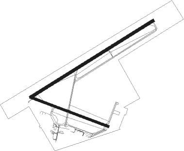
Runway info
Runway 07 / 25  | ||
| length | 2747m (9012ft) | |
| bearing | 69° / 249° | |
| width | 61m (200ft) | |
| surface | asphalt | |
| displ threshold | 275m (902ft) / 348m (1142ft) | |
| Runway 12 / 30 | ||
| length | 1572m (5157ft) | |
| bearing | 109° / 289° | |
| width | 46m (151ft) | |
| surface | asphalt | |
| displ threshold | 174m (571ft) / 99m (325ft) | |
Nearby beacons
| code | identifier | dist | bearing | frequency |
|---|---|---|---|---|
| QG | WINDSOR NDB | 4.4 | 67° | 353 |
| DM | SPENC (DETROIT) NDB | 11.5 | 257° | 223 |
| RYS | GROSSE ILE (DETROIT) NDB | 13.6 | 228° | 419 |
| DXO | DETROIT VOR/DME | 18.6 | 261° | 113.40 |
| MTC | SELFRIDGE (MOUNT CLEMENS) TACAN | 20.9 | 20° | 133.70 |
| DT | REVUP (DETROIT) NDB | 23.1 | 252° | 388 |
| CRL | CARLETON VOR/DME | 26.2 | 246° | 115.70 |
| SVM | SALEM VORTAC | 29.4 | 282° | 114.30 |
| PSI | DME | 36.1 | 306° | 111 |
| PH | PHURN (PORT HURON) NDB | 37.5 | 32° | 332 |
| TCU | TECUMSEH NDB | 43.9 | 255° | 239 |
| PCW | PORT CLINTON NDB | 45.6 | 173° | 423 |
| FNT | FLINT VORTAC | 54.2 | 311° | 116.90 |
| TOL | TOLEDO TACAN | 55.6 | 231° | 112.50 |
| ECK | PECK TACAN | 59.7 | 14° | 114 |
| TO | TOPHR (TOLEDO) NDB | 61.2 | 233° | 219 |
| DJB | DRYER VOR/DME | 65.5 | 139° | 113.60 |
Departure and arrival routes
| Transition altitude | 18000ft |
| Transition level | 18000ft |
| SID end points | distance | outbound heading | |
|---|---|---|---|
| RW07 | |||
| ZETTR3 | 52mi | 37° | |
| CYQG5 | 10mi | 68° | |
| HHOWE3 | 64mi | 91° | |
| PAVYL2 | 62mi | 98° | |
| LIDDS2 | 106mi | 125° | |
| CLVIN2 | 208mi | 200° | |
| BARII2 | 127mi | 218° | |
| SNDRS2 | 113mi | 224° | |
| CCOBB2 | 95mi | 269° | |
| KAYLN2 | 141mi | 273° | |
| MIGGY2 | 112mi | 301° | |
| TRMML3 | 92mi | 334° | |
| METRO3 | 38mi | 344° | |
| RW12 | |||
| ZETTR3 | 52mi | 37° | |
| CYQG5 | 10mi | 68° | |
| HHOWE3 | 64mi | 91° | |
| PAVYL2 | 62mi | 98° | |
| LIDDS2 | 106mi | 125° | |
| CLVIN2 | 208mi | 200° | |
| BARII2 | 127mi | 218° | |
| SNDRS2 | 113mi | 224° | |
| CCOBB2 | 95mi | 269° | |
| KAYLN2 | 141mi | 273° | |
| MIGGY2 | 112mi | 301° | |
| TRMML3 | 92mi | 334° | |
| METRO3 | 38mi | 344° | |
| RW25 | |||
| ZETTR3 | 52mi | 37° | |
| CYQG5 | 10mi | 68° | |
| HHOWE3 | 64mi | 91° | |
| PAVYL2 | 62mi | 98° | |
| LIDDS2 | 106mi | 125° | |
| CLVIN2 | 208mi | 200° | |
| BARII2 | 127mi | 218° | |
| SNDRS2 | 113mi | 224° | |
| CCOBB2 | 95mi | 269° | |
| KAYLN2 | 141mi | 273° | |
| MIGGY2 | 112mi | 301° | |
| TRMML3 | 92mi | 334° | |
| METRO3 | 38mi | 344° | |
| RW30 | |||
| ZETTR3 | 52mi | 37° | |
| CYQG5 | 10mi | 68° | |
| HHOWE3 | 64mi | 91° | |
| PAVYL2 | 62mi | 98° | |
| LIDDS2 | 106mi | 125° | |
| CLVIN2 | 208mi | 200° | |
| BARII2 | 127mi | 218° | |
| SNDRS2 | 113mi | 224° | |
| CCOBB2 | 95mi | 269° | |
| KAYLN2 | 141mi | 273° | |
| MIGGY2 | 112mi | 301° | |
| TRMML3 | 92mi | 334° | |
| METRO3 | 38mi | 344° | |
| STAR starting points | distance | inbound heading | |
|---|---|---|---|
| ALL | |||
| PETTE2 | 62.9 | 82° | |
| RRALF3 | 58.6 | 102° | |
| GIGGY2 | 54.3 | 240° | |
| FOREY2 | 29.1 | 327° | |
Instrument approach procedures
| runway | airway (heading) | route (dist, bearing) |
|---|---|---|
| RW07 | IPTOD (47°) | IPTOD DUNTO (5mi, 325°) 2200ft |
| RNAV | DUNTO 2200ft KEDLI (6mi, 69°) 2000ft CYQG (5mi, 71°) 674ft OKURI (8mi, 68°) 2800ft OKURI (turn) | |
| RW25 | LEXOS (225°) | LEXOS AMBIM (5mi, 145°) 2200ft |
| RW25 | MOGAK (268°) | MOGAK AMBIM (5mi, 325°) 2200ft |
| RNAV | AMBIM 2200ft SELAB (6mi, 249°) 2000ft CYQG (5mi, 247°) 663ft (5092mi, 117°) 1200ft MOGAK (5081mi, 297°) 2800ft MOGAK (turn) | |
| RW30 | IRLIP (315°) | IRLIP MEMLO (5mi, 33°) 2200ft |
| RW30 | ITBIG (272°) | ITBIG MEMLO (5mi, 213°) 2200ft |
| RNAV | MEMLO 2200ft VIBRA (6mi, 290°) 2000ft CYQG (4mi, 294°) 671ft (5092mi, 117°) 1200ft IRLIP (5085mi, 297°) 2800ft IRLIP (turn) |
Holding patterns
| STAR name | hold at | type | turn | heading* | altitude | leg | speed limit |
|---|---|---|---|---|---|---|---|
| FOREY2 | FOREY | VHF | right | 144 (324)° | DME 10.0mi | ICAO rules | |
| PETTE2 | PETTE | VHF | left | 241 (61)° | DME 10.0mi | ICAO rules | |
| *) magnetic outbound (inbound) holding course | |||||||
Disclaimer
The information on this website is not for real aviation. Use this data with the X-Plane flight simulator only! Data taken with kind consent from X-Plane 12 source code and data files. Content is subject to change without notice.