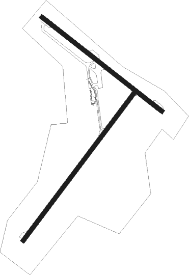
Yarmouth
Airport details
| Country | Canada |
| State | Nova Scotia |
| Region | CY |
| Airspace | Moncton Ctr |
| Municipality | Arcadia |
| Elevation | 141ft (43m) |
| Timezone | GMT -4 |
| Coordinates | 43.82718, -66.08826 |
| Magnetic var | |
| Type | land |
| Available since | X-Plane v10.40 |
| ICAO code | CYQI |
| IATA code | YQI |
| FAA code | n/a |
Communication
| Yarmouth MF | 123.000 |
Nearby beacons
| code | identifier | dist | bearing | frequency |
|---|---|---|---|---|
| YQI | YARMOUTH VOR/DME | 0.2 | 110° | 113.30 |
| QI | YARMOUTH NDB | 2.5 | 228° | 206 |
| AC | PLEASANT LAKE (YARMOUTH) NDB | 2.7 | 53° | 230 |
Instrument approach procedures
| runway | airway (heading) | route (dist, bearing) |
|---|---|---|
| RW06 | APNOT (22°) | APNOT DUREV (5mi, 303°) 1500ft |
| RW06 | IGVUP (72°) | IGVUP DUREV (5mi, 123°) 1500ft |
| RNAV | DUREV 1500ft EBMEP (6mi, 51°) 1500ft CYQI (5mi, 50°) 188ft HAVNN (4mi, 52°) 1800ft HAVNN (turn) | |
| RW15 | DUNPI (104°) | DUNPI BOXAB (5mi, 52°) 1500ft |
| RW15 | IMUMA (152°) | IMUMA BOXAB (5mi, 232°) 1500ft |
| RNAV | BOXAB 1500ft AMEBU (6mi, 124°) 1500ft CYQI (5mi, 127°) 172ft PUTOM (4mi, 120°) 1700ft PUTOM (turn) 1700ft | |
| RW24 | APGIN (253°) | APGIN MEGMI (5mi, 303°) 1500ft |
| RW24 | KEKDI (202°) | KEKDI MEGMI (5mi, 123°) 1500ft |
| RNAV | MEGMI 1500ft PEKRU (6mi, 231°) 1500ft CYQI (4mi, 232°) 165ft SASUR (5mi, 230°) 1800ft SASUR (turn) | |
| RW33 | BOSIR (282°) | BOSIR KIPOT (5mi, 232°) 1500ft |
| RW33 | LEVUB (329°) | LEVUB KIPOT (5mi, 52°) 1500ft |
| RNAV | KIPOT 1500ft ALOVI (6mi, 304°) 1500ft CYQI (5mi, 300°) 154ft OMSAP (5mi, 307°) 1800ft OMSAP (turn) 1800ft |
Disclaimer
The information on this website is not for real aviation. Use this data with the X-Plane flight simulator only! Data taken with kind consent from X-Plane 12 source code and data files. Content is subject to change without notice.

