Regina - Regina Intl
Airport details
| Country | Canada |
| State | Saskatchewan |
| Region | CY |
| Airspace | Winnipeg Ctr |
| Municipality | Regina |
| Elevation | 1894ft (577m) |
| Timezone | GMT -6 |
| Coordinates | 50.43219, -104.66605 |
| Magnetic var | |
| Type | land |
| Available since | X-Plane v10.40 |
| ICAO code | CYQR |
| IATA code | YQR |
| FAA code | YQR |
Communication
| Regina Intl ATIS | 127.000 |
| Regina Intl Ground Control | 121.900 |
| Regina Intl Tower | 118.600 |
Approach frequencies
| ILS-cat-I | RW13 | 109.5 | 18.00mi |
| 3° GS | RW13 | 109.5 | 18.00mi |
Nearby Points of Interest:
Saskatchewan Legislative Building
-the hotel saskatchewan, autograph collection
-Prince Edward Building
-Last Mountain House Provincial Park
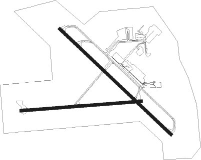
Runway info
Runway 08 / 26  | ||
| length | 1881m (6171ft) | |
| bearing | 90° / 270° | |
| width | 46m (151ft) | |
| surface | asphalt | |
| blast zone | 0m (0ft) / 30m (98ft) | |
| Runway 13 / 31 | ||
| length | 2401m (7877ft) | |
| bearing | 125° / 305° | |
| width | 46m (151ft) | |
| surface | asphalt | |
| blast zone | 29m (95ft) / 30m (98ft) | |
Nearby beacons
| code | identifier | dist | bearing | frequency |
|---|---|---|---|---|
| ZRS | AJAX (REGINA) NDB | 4.1 | 307° | 219 |
| QR | REGINA NDB | 5.1 | 124° | 290 |
| ZQR | FINDLAY (REGINA) NDB | 5.3 | 91° | 204 |
| VLN | LUMSDEN VORTAC | 16.4 | 316° | 114.20 |
| YMJ | MOOSE JAW VORTAC | 34.8 | 264° | 113.40 |
Departure and arrival routes
| Transition altitude | 18000ft |
| Transition level | 18000ft |
| STAR starting points | distance | inbound heading | |
|---|---|---|---|
| RW08 | |||
| ODGOV6 | 30.8 | 102° | |
| ANTOS6 | 29.1 | 117° | |
| KEMKA6 | 29.5 | 270° | |
| GORAK2 | 35.0 | 304° | |
| RW13 | |||
| ODGOV6 | 30.8 | 102° | |
| ANTOS6 | 29.1 | 117° | |
| KEMKA6 | 29.5 | 270° | |
| GORAK2 | 35.0 | 304° | |
| RW26 | |||
| ODGOV6 | 30.8 | 102° | |
| ANTOS6 | 29.1 | 117° | |
| KEMKA6 | 29.5 | 270° | |
| GORAK2 | 35.0 | 304° | |
| RW31 | |||
| ODGOV6 | 30.8 | 102° | |
| ANTOS6 | 29.1 | 117° | |
| KEMKA6 | 29.5 | 270° | |
| GORAK2 | 35.0 | 304° | |
Instrument approach procedures
| runway | airway (heading) | route (dist, bearing) |
|---|---|---|
| RW08-Z | DENTU (73°) | DENTU 4000ft MIBMO (5mi, 360°) 4000ft |
| RW08-Z | OLANI (106°) | OLANI MIBMO (5mi, 180°) 4000ft |
| RNAV | MIBMO 4000ft TOVAB (6mi, 90°) 3300ft XUBOK (3mi, 90°) 2300ft CYQR (2mi, 86°) 1939ft ERDAP (10mi, 91°) 5000ft ERDAP (turn) | |
| RW13-Y | CHEPS (126°) | CHEPS 4000ft VESRO (6mi, 125°) 3300ft |
| RW13-Y | KEBSI (209°) | KEBSI 6000ft TUGIM (2mi, 305°) 5400ft VESRO (5mi, 240°) 3300ft |
| RNAV | VESRO 3300ft CYQR (5mi, 127°) 1947ft MUVAN (11mi, 125°) 5000ft MUVAN (turn) | |
| RW13-Z | APNEN (105°) | APNEN CHEPS (5mi, 60°) 4000ft |
| RW13-Z | NADUP (156°) | NADUP 4000ft CHEPS (5mi, 240°) 4000ft |
| RNAV | CHEPS 4000ft VESRO (6mi, 125°) 3300ft CYQR (5mi, 127°) 1947ft MUVAN (11mi, 125°) 5000ft MUVAN (turn) | |
| RW26-Y | ERDAP (271°) | ERDAP 4000ft TANPU (6mi, 270°) 3300ft |
| RW26-Y | OMTUT (219°) | OMTUT 6000ft VIXOT (2mi, 90°) 5400ft TANPU (5mi, 180°) 3300ft |
| RNAV | TANPU 3300ft CYQR (5mi, 271°) 1940ft MIBMO (11mi, 269°) 5000ft MIBMO (turn) | |
| RW26-Z | BOBKU (254°) | BOBKU 4000ft ERDAP (5mi, 180°) 4000ft |
| RW26-Z | OMSOV (288°) | OMSOV ERDAP (5mi, 0°) 4000ft |
| RNAV | ERDAP 4000ft TANPU (6mi, 270°) 3300ft CYQR (5mi, 271°) 1940ft MIBMO (11mi, 269°) 5000ft MIBMO (turn) | |
| RW31-Y | MUVAN (305°) | MUVAN 4000ft ROSLI (6mi, 305°) 3300ft |
| RW31-Y | SEBIX (26°) | SEBIX 6000ft USBOP (2mi, 125°) 5400ft ROSLI (5mi, 60°) 3300ft |
| RW31-Y | URTEX (282°) | URTEX 7000ft PESDU (9mi, 273°) 4500ft ILODU (2mi, 273°) 3900ft ROSLI (2mi, 288°) 3300ft |
| RNAV | ROSLI 3300ft CYQR (5mi, 304°) 1940ft CHEPS (11mi, 306°) 5000ft CHEPS (turn) | |
| RW31-Z | IGVEX (333°) | IGVEX 4000ft MUVAN (5mi, 60°) 4000ft |
| RW31-Z | RADIP (285°) | RADIP MUVAN (5mi, 240°) 4000ft |
| RNAV | MUVAN 4000ft ROSLI (6mi, 305°) 3300ft CYQR (5mi, 304°) 1940ft CHEPS (11mi, 306°) 5000ft CHEPS (turn) |
Holding patterns
| STAR name | hold at | type | turn | heading* | altitude | leg | speed limit |
|---|---|---|---|---|---|---|---|
| ANTOS6 | ANTOS | VHF | left | 283 (103)° | 1.0min timed | ICAO rules | |
| ANTOS6 | CHEPS | VHF | right | 308 (128)° | 1.0min timed | ICAO rules | |
| GORAK2 | GORAK | VHF | right | 177 (357)° | 1.0min timed | 265 | |
| GORAK2 | MUVAN | VHF | right | 128 (308)° | 1.0min timed | 265 | |
| KEMKA6 | KEMKA | VHF | left | 90 (270)° | > 5000ft | 1.0min timed | ICAO rules |
| KEMKA6 | MUVAN | VHF | right | 128 (308)° | 1.0min timed | 265 | |
| ODGOV6 | CHEPS | VHF | right | 308 (128)° | 1.0min timed | ICAO rules | |
| ODGOV6 | ODGOV | VHF | left | 263 (83)° | 1.0min timed | ICAO rules | |
| *) magnetic outbound (inbound) holding course | |||||||
Disclaimer
The information on this website is not for real aviation. Use this data with the X-Plane flight simulator only! Data taken with kind consent from X-Plane 12 source code and data files. Content is subject to change without notice.