St Thomas - St. Thomas Muni
Airport details
| Country | Canada |
| State | Ontario |
| Region | CY |
| Airspace | Toronto Ctr |
| Municipality | Central Elgin |
| Elevation | 776ft (237m) |
| Timezone | GMT -5 |
| Coordinates | 42.77551, -81.10078 |
| Magnetic var | |
| Type | land |
| Available since | X-Plane v10.40 |
| ICAO code | CYQS |
| IATA code | YQS |
| FAA code | n/a |
Communication
| ST. Thomas Muni CTAF/UNICOM | 122.700 |
Nearby Points of Interest:
Canada Southern Railway Station
-BX InterlockingTower
-Port Stanley
-London Normal School
-Annandale National Historic Site
-Old Woodstock Town Hall
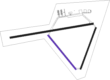
Runway info
Runway 09 / 27  | ||
| length | 1529m (5016ft) | |
| bearing | 86° / 266° | |
| width | 30m (100ft) | |
| surface | asphalt | |
| Runway 03 / 21 | ||
| length | 795m (2608ft) | |
| bearing | 32° / 212° | |
| width | 23m (75ft) | |
| surface | asphalt | |
| Runway 15 / 33 | ||
| length | 796m (2612ft) | |
| bearing | 137° / 317° | |
| width | 23m (75ft) | |
| surface | asphalt | |
Nearby beacons
| code | identifier | dist | bearing | frequency |
|---|---|---|---|---|
| YXU | LONDON VOR/DME | 15.9 | 350° | 117.20 |
| FD | BRANTFORD NDB | 35 | 66° | 207 |
| WT | (KITCHENER) DME | 51.7 | 47° | 115 |
| ZKF | WELLINGTON (KITCHENER) NDB | 55.9 | 49° | 335 |
| ERI | ERIE VORTAC | 57.9 | 133° | 109.40 |
Instrument approach procedures
| runway | airway (heading) | route (dist, bearing) |
|---|---|---|
| RW09 | AXIPA (105°) | AXIPA EPRAN (6mi, 173°) 2400ft |
| RW09 | GABEP (66°) | GABEP EPRAN (6mi, 353°) 2400ft |
| RNAV | EPRAN 2400ft FAZEO (6mi, 86°) 2400ft CYQS (6mi, 85°) 819ft EBLIK (8mi, 87°) 3000ft EBLIK (turn) | |
| RW27 | BOVUT (267°) | BOVUT ODGUT (5mi, 266°) 2500ft |
| RW27 | XOSAP (287°) | XOSAP ODGUT (6mi, 353°) 2500ft |
| RNAV | ODGUT 2500ft DUTIM (6mi, 266°) 2400ft CYQS (5mi, 267°) 814ft URPEN (10mi, 266°) 3000ft URPEN (turn) |
Disclaimer
The information on this website is not for real aviation. Use this data with the X-Plane flight simulator only! Data taken with kind consent from X-Plane 12 source code and data files. Content is subject to change without notice.