Grande Prairie
Airport details
| Country | Canada |
| State | Alberta |
| Region | CY |
| Airspace | Edmonton Ctr |
| Municipality | Grande Prairie |
| Elevation | 2191ft (668m) |
| Timezone | GMT -7 |
| Coordinates | 55.18190, -118.88719 |
| Magnetic var | |
| Type | land |
| Available since | X-Plane v10.40 |
| ICAO code | CYQU |
| IATA code | YQU |
| FAA code | YQU |
Communication
| Grande Prairie ATIS | 128.600 |
| Grande Prairie Clearance Delivery | 121.900 |
| Grande Prairie MF GRAND PRAIRIE RDO | 118.100 |
Approach frequencies
| ILS-cat-I | RW30 | 109.9 | 18.00mi |
| 3° GS | RW30 | 109.9 | 18.00mi |
Runway info
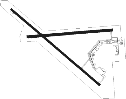
Runway 12 / 30  | ||
| length | 2589m (8494ft) | |
| bearing | 120° / 300° | |
| width | 46m (150ft) | |
| surface | asphalt | |
| displ threshold | 122m (400ft) / 0m (0ft) | |
| Runway 07 / 25 | ||
| length | 1887m (6191ft) | |
| bearing | 90° / 270° | |
| width | 61m (200ft) | |
| surface | asphalt | |
Nearby beacons
| code | identifier | dist | bearing | frequency |
|---|---|---|---|---|
| QU | GRANDE PRAIRIE NDB | 3.6 | 121° | 221 |
| YQU | GRANDE PRAIRIE VOR/DME | 4.9 | 267° | 113.10 |
| 8C | FAIRVIEW NDB | 55.7 | 27° | 295 |
Instrument approach procedures
| runway | airway (heading) | route (dist, bearing) |
|---|---|---|
| RW07-Y | DUTLA (90°) | DUTLA 5000ft EMIKI (6mi, 90°) 3600ft |
| RW07-Y | SIDLO (64°) | SIDLO 7000ft XUGUN (8mi, 38°) 4500ft EMIKI (3mi, 70°) 3600ft |
| RW07-Y | UKIMA (32°) | UKIMA 7000ft XIKED (5mi, 296°) 5500ft XUGUN (3mi, 339°) 4500ft EMIKI (3mi, 70°) 3600ft |
| RNAV | EMIKI 3600ft CYQU (5mi, 91°) 2245ft OTPOX (11mi, 90°) 6000ft OTPOX (turn) | |
| RW07-Z | ITMET (106°) | ITMET DUTLA (5mi, 179°) 4500ft |
| RW07-Z | XOPUS (75°) | XOPUS DUTLA (5mi, 359°) 4500ft |
| RNAV | DUTLA 4500ft EMIKI (6mi, 90°) 3600ft UKSIB (2mi, 90°) 2880ft CYQU (2mi, 92°) 2245ft OTPOX (11mi, 90°) 6000ft OTPOX (turn) | |
| RW12-Y | DEMDO (80°) | DEMDO 7000ft XORGI (6mi, 38°) 5000ft BIVGA (4mi, 84°) 3600ft |
| RW12-Y | KIVUG (119°) | KIVUG 5000ft BIVGA (6mi, 119°) 3600ft |
| RW12-Y | MEBAG (66°) | MEBAG 7000ft XOROX (4mi, 305°) 5700ft XORGI (3mi, 347°) 5000ft BIVGA (4mi, 84°) 3600ft |
| RW12-Y | RUDGA (229°) | RUDGA 7000ft XEXET (4mi, 289°) 5600ft BIVGA (5mi, 233°) 3600ft |
| RNAV | BIVGA 3600ft CYQU (5mi, 119°) 2245ft IKBIR (11mi, 120°) 6000ft IKBIR (turn) | |
| RW12-Z | ALUVU (101°) | ALUVU KIVUG (5mi, 60°) 3900ft |
| RW12-Z | MURAV (147°) | MURAV KIVUG (5mi, 240°) 3900ft |
| RNAV | KIVUG 3900ft BIVGA (6mi, 119°) 3600ft CYQU (5mi, 119°) 2245ft IKBIR (11mi, 120°) 6000ft IKBIR (turn) | |
| RW25-Y | MAXEP (308°) | MAXEP 7000ft XUGLO (5mi, 42°) 5500ft XUKBI (3mi, 343°) 4500ft BOTUN (2mi, 283°) 3900ft |
| RW25-Y | OMSIT (285°) | OMSIT 7000ft XUKBI (8mi, 299°) 4500ft BOTUN (2mi, 283°) 3900ft |
| RW25-Y | OTPOX (270°) | OTPOX 5000ft BOTUN (5mi, 270°) 3900ft |
| RNAV | BOTUN 3900ft CYQU (6mi, 269°) 2242ft DUTLA (10mi, 270°) 6000ft DUTLA (turn) | |
| RW25-Z | DUPUX (254°) | DUPUX OTPOX (5mi, 180°) 4100ft |
| RW25-Z | EBMIP (285°) | EBMIP OTPOX (5mi, 0°) 4100ft |
| RNAV | OTPOX 4100ft BOTUN (5mi, 270°) 3900ft ANEVA (3mi, 270°) 2820ft CYQU (2mi, 268°) 2242ft DUTLA (10mi, 270°) 6000ft DUTLA (turn) | |
| RW30-Y | IKBIR (300°) | IKBIR 5000ft ROLPA (6mi, 300°) 3600ft |
| RW30-Y | IKNOL (358°) | IKNOL 7000ft XESUG (8mi, 41°) 4500ft ROLPA (3mi, 344°) 3600ft |
| RNAV | ROLPA 3600ft CYQU (5mi, 300°) 2249ft KIVUG (11mi, 299°) 6000ft KIVUG (turn) | |
| RW30-Z | DEKSA (282°) | DEKSA IKBIR (5mi, 240°) 3600ft |
| RW30-Z | MOBOB (328°) | MOBOB IKBIR (5mi, 60°) 3600ft |
| RNAV | IKBIR 3600ft ROLPA (6mi, 300°) 3600ft CYQU (5mi, 300°) 2249ft KIVUG (11mi, 299°) 6000ft KIVUG (turn) |
Disclaimer
The information on this website is not for real aviation. Use this data with the X-Plane flight simulator only! Data taken with kind consent from X-Plane 12 source code and data files. Content is subject to change without notice.