Rivière-du-loup - Riviere Du Loup
Airport details
| Country | Canada |
| State | Quebec |
| Region | CY |
| Airspace | Montreal Ctr |
| Municipality | Notre-Dame du-Portage |
| Elevation | 424ft (129m) |
| Timezone | GMT -5 |
| Coordinates | 47.76138, -69.58243 |
| Magnetic var | |
| Type | land |
| Available since | X-Plane v10.40 |
| ICAO code | CYRI |
| IATA code | YRI |
| FAA code | n/a |
Communication
| Riviere du Loup CTAF/UNICOM | 122.800 |
| Riviere du Loup unnamed entity | 128.800 |
Nearby Points of Interest:
Sir John A. Macdonald’s Summer Residence
-Rivière-du-Loup Town Hall
-Baie de l'Isle-Verte
-Chapais House
-Moulin du Petit-Sault
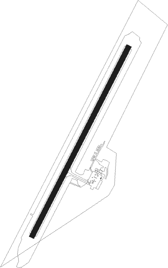
Runway info
| Runway 05 / 23 | ||
| length | 1831m (6007ft) | |
| bearing | 42° / 222° | |
| width | 46m (150ft) | |
| surface | asphalt | |
Nearby beacons
| code | identifier | dist | bearing | frequency |
|---|---|---|---|---|
| RI | RIVIERE-DU-LOUP NDB | 0.2 | 62° | 201 |
| YRI | RIVIERE DU LOUP VOR | 0.3 | 232° | 113.90 |
Instrument approach procedures
| runway | airway (heading) | route (dist, bearing) |
|---|---|---|
| RW05-Y | DUPUN (43°) | DUPUN BOMUV (6mi, 42°) 2000ft |
| RW05-Y | ILUVO (72°) | ILUVO BOMUV (6mi, 112°) 2000ft |
| RW05-Y | KEBAG (0°) | KEBAG BOMUV (6mi, 293°) 2000ft |
| RNAV | BOMUV 2000ft AVOPU (5mi, 42°) 1800ft SENGA (2mi, 42°) 1110ft CYRI (2mi, 47°) 470ft LIDAP (9mi, 41°) 2200ft LIDAP (turn) | |
| RW05-Z | DUPUN (43°) | DUPUN BOMUV (6mi, 42°) 2000ft |
| RW05-Z | ILUVO (72°) | ILUVO BOMUV (6mi, 112°) 2000ft |
| RW05-Z | KEBAG (0°) | KEBAG BOMUV (6mi, 293°) 2000ft |
| RNAV | BOMUV 2000ft AVOPU (5mi, 42°) 1800ft SENGA (2mi, 42°) 1110ft VOGUS (1mi, 42°) 632ft LIDAP (10mi, 42°) 2200ft LIDAP (turn) | |
| RW23-Y | NUBIB (222°) | NUBIB LIDAP (5mi, 223°) 2000ft |
| RW23-Y | OMVOS (177°) | OMVOS LIDAP (6mi, 112°) 2000ft |
| RW23-Y | ULAPU (252°) | ULAPU LIDAP (6mi, 293°) 2000ft |
| RNAV | LIDAP 2000ft GUBED (5mi, 222°) 1800ft CYRI (4mi, 220°) 481ft BOMUV (10mi, 223°) 2000ft BOMUV (turn) | |
| RW23-Z | NUBIB (222°) | NUBIB LIDAP (5mi, 223°) 1800ft |
| RW23-Z | OMVOS (177°) | OMVOS LIDAP (6mi, 112°) 1800ft |
| RW23-Z | ULAPU (252°) | ULAPU LIDAP (6mi, 293°) 2000ft |
| RNAV | LIDAP 1800ft GUBED (5mi, 222°) 1800ft AXOMO (2mi, 223°) 1060ft CYRI (2mi, 217°) 481ft BOMUV (10mi, 223°) 2000ft BOMUV (turn) |
Disclaimer
The information on this website is not for real aviation. Use this data with the X-Plane flight simulator only! Data taken with kind consent from X-Plane 12 source code and data files. Content is subject to change without notice.