Red Lake
Airport details
| Country | Canada |
| State | Ontario |
| Region | CY |
| Airspace | Winnipeg Ctr |
| Municipality | Red Lake |
| Elevation | 1266ft (386m) |
| Timezone | GMT -6 |
| Coordinates | 51.06709, -93.79305 |
| Magnetic var | |
| Type | land |
| Available since | X-Plane v10.40 |
| ICAO code | CYRL |
| IATA code | YRL |
| FAA code | n/a |
Communication
| Red Lake CTAF | 122.300 |
| Red Lake WINNIPEG CNTR | 135.325 |
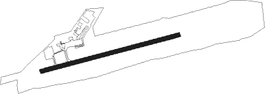
Runway info
| Runway 08 / 26 | ||
| length | 1529m (5016ft) | |
| bearing | 83° / 263° | |
| width | 46m (150ft) | |
| surface | asphalt | |
Nearby beacons
| code | identifier | dist | bearing | frequency |
|---|---|---|---|---|
| RL | RED LAKE NDB | 0.4 | 127° | 218 |
| YRL | RED LAKE VOR/DME | 1.2 | 82° | 114 |
Instrument approach procedures
| runway | airway (heading) | route (dist, bearing) |
|---|---|---|
| RW08 | KAVIR (99°) | KAVIR EBMER (5mi, 163°) 2600ft |
| RW08 | XIKUS (65°) | XIKUS EBMER (5mi, 343°) 2600ft |
| RNAV | EBMER 2600ft NOTAG (6mi, 83°) 2600ft CYRL (5mi, 83°) 1287ft IMIKO (5mi, 83°) 3000ft IMIKO (turn) | |
| RW26 | IKDAV (245°) | IKDAV OMROK (5mi, 164°) 2800ft |
| RW26 | XORUP (280°) | XORUP OMROK (5mi, 344°) 2800ft |
| RNAV | OMROK 2800ft MIRIM (6mi, 263°) 2600ft CYRL (4mi, 263°) 1316ft BUBUP (5mi, 263°) 3000ft BUBUP (turn) |
Disclaimer
The information on this website is not for real aviation. Use this data with the X-Plane flight simulator only! Data taken with kind consent from X-Plane 12 source code and data files. Content is subject to change without notice.