Sherbrooke - Aeroport De Sherbrooke
Airport details
| Country | Canada |
| State | Quebec |
| Region | CY |
| Airspace | Montreal Ctr |
| Municipality | Cookshire-Eaton |
| Elevation | 791ft (241m) |
| Timezone | GMT -5 |
| Coordinates | 45.43848, -71.69135 |
| Magnetic var | |
| Type | land |
| Available since | X-Plane v10.30 |
| ICAO code | CYSC |
| IATA code | YSC |
| FAA code | n/a |
Communication
| Aeroport de Sherbrooke AWOS | 126.250 |
| Aeroport de Sherbrooke CTAF/UNICOM | 123.500 |
| Aeroport de Sherbrooke MONTREAL CENTER | 132.550 |
Nearby Points of Interest:
East Angus railway station
-Sherbrooke Canadian National railway station
-Sherbrooke City Hall
-Sherbrooke Canadian Pacific railway station
-Château d'eau de la rue Dominion
-Coaticook railway station
-Magog Textile Mill
-bureau d'enregistrement de Richmond
-Richmond Railway Station
-Parc Morrison
-Moulin Denison
-Hôtel de ville de Cassville
-Indian Stream Schoolhouse
-Alice M. Ward Library
-Moulin Legendre
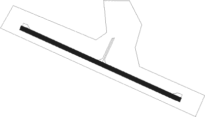
Runway info
| Runway 13 / 31 | ||
| length | 1800m (5906ft) | |
| bearing | 111° / 291° | |
| width | 46m (150ft) | |
| surface | asphalt | |
Nearby beacons
| code | identifier | dist | bearing | frequency |
|---|---|---|---|---|
| YSC | DME | 8.3 | 218° | 113.20 |
| Y8 | DRUMMONDVILLE NDB | 38.5 | 300° | 401 |
| VLV | DME | 45.9 | 60° | 117.20 |
| RQM | RANGELEY NDB | 49.9 | 118° | 221 |
| BML | DME | 52.8 | 148° | 116.55 |
| YRQ | TROIS-RIVIERES NDB | 69.1 | 314° | 205 |
Instrument approach procedures
| runway | airway (heading) | route (dist, bearing) |
|---|---|---|
| RW13 | EMEGA (99°) | EMEGA CUVIE (6mi, 78°) 2400ft |
| RW13 | ETLES (111°) | ETLES CUVIE (7mi, 111°) 2400ft |
| RNAV | CUVIE 2400ft AGIWA (5mi, 111°) 2300ft XOXIS (3mi, 111°) 1440ft CYSC (2mi, 111°) 804ft VITEG (9mi, 111°) 3300ft VITEG (turn) | |
| RW31 | DERPI (274°) | DERPI KAXIR (5mi, 218°) 3100ft |
| RW31 | KEDID (313°) | KEDID KAXIR (5mi, 38°) 3100ft |
| RNAV | KAXIR 3100ft DEDMI (6mi, 291°) 2400ft ALNAP (3mi, 291°) 1420ft CYSC (2mi, 291°) 842ft ULBUK (9mi, 291°) 3300ft ULBUK (turn) |
Disclaimer
The information on this website is not for real aviation. Use this data with the X-Plane flight simulator only! Data taken with kind consent from X-Plane 12 source code and data files. Content is subject to change without notice.