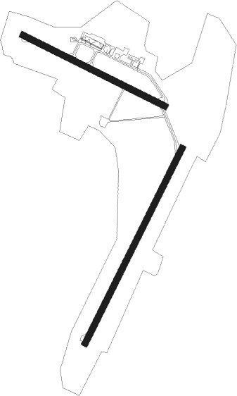
Saint John
Airport details
| Country | Canada |
| State | New Brunswick |
| Region | CY |
| Airspace | Moncton Ctr |
| Municipality | Saint John |
| Elevation | 354ft (108m) |
| Timezone | GMT -4 |
| Coordinates | 45.31616, -65.89012 |
| Magnetic var | |
| Type | land |
| Available since | X-Plane v10.40 |
| ICAO code | CYSJ |
| IATA code | YSJ |
| FAA code | n/a |
Communication
| Saint John MF | 118.500 |
Approach frequencies
| ILS-cat-I | RW05 | 108.3 | 18.00mi |
| ILS-cat-I | RW23 | 110.5 | 18.00mi |
| 3° GS | RW05 | 108.3 | 18.00mi |
| 3° GS | RW23 | 110.5 | 18.00mi |
Nearby beacons
| code | identifier | dist | bearing | frequency |
|---|---|---|---|---|
| SJ | SAINT JOHN NDB | 5.4 | 43° | 212 |
| YSJ | SAINT JOHN VOR/DME | 5.5 | 12° | 113.50 |
| ZST | ALPINE (SAINT JOHN) NDB | 6 | 218° | 397 |
| YZX | GREENWOOD NDB | 40.9 | 117° | 266 |
| YFC | FREDERICTON VOR/DME | 41.2 | 318° | 113 |
| UZX | GREENWOOD TACAN | 45.7 | 109° | 117.60 |
| FC | FREDERICTON NDB | 46.8 | 310° | 326 |
Departure and arrival routes
| Transition altitude | 18000ft |
| Transition level | 18000ft |
| SID end points | distance | outbound heading | |
|---|---|---|---|
| RW05 | |||
| YSJ4 | 16mi | 41° | |
| RW14 | |||
| YSJ4 | 16mi | 41° | |
| RW23 | |||
| YSJ4 | 16mi | 41° | |
| RW32 | |||
| HAMTN3, MOWND1 | 16mi | 41° | |
Instrument approach procedures
| runway | airway (heading) | route (dist, bearing) |
|---|---|---|
| RW05-Y | CROSI (39°) | CROSI 3000ft OMLUR (7mi, 40°) 1400ft |
| RW05-Y | EMBUD (77°) | EMBUD 5000ft VIXEB (9mi, 93°) 2200ft OMLUR (3mi, 70°) 1400ft |
| RW05-Y | ITMAK (192°) | ITMAK 5000ft KEPMI (11mi, 213°) 5000ft ROLTA (9mi, 213°) 5000ft UDKOG (4mi, 201°) 3600ft VIXEB (4mi, 135°) 2200ft OMLUR (3mi, 70°) 1400ft |
| RW05-Y | TADOP (312°) | TADOP 5000ft ONGUX (7mi, 277°) 2900ft OMLUR (4mi, 327°) 1400ft |
| RNAV | OMLUR 1400ft CYSJ (4mi, 36°) 348ft BOOTI (11mi, 42°) 3000ft BOOTI (turn) | |
| RW05-Z | DASGU (8°) | DASGU CROSI (5mi, 293°) 2200ft |
| RW05-Z | ITMAK (192°) | ITMAK KEPMI (11mi, 213°) 2900ft ADVAM (20mi, 213°) 2200ft CROSI (5mi, 113°) 2200ft |
| RNAV | CROSI 2200ft KAVKA (6mi, 40°) 1700ft CYSJ (5mi, 37°) 348ft BOOTI (11mi, 42°) 3000ft BOOTI (turn) 3000ft | |
| RW14-Y | ANVUB (97°) | ANVUB 5000ft ROGNI (9mi, 92°) 5000ft UKPIB (10mi, 93°) 1800ft NOPUX (1mi, 102°) 1500ft |
| RW14-Y | EBGID (115°) | EBGID 3000ft NOPUX (7mi, 113°) 1500ft |
| RW14-Y | ITMAK (192°) | ITMAK 5000ft VIRBA (9mi, 231°) 5000ft IKDOD (8mi, 202°) 2800ft NOPUX (4mi, 151°) 1500ft |
| RW14-Y | TULUT (200°) | TULUT 5000ft OTSUK (3mi, 283°) 4300ft IKDOD (5mi, 250°) 2800ft NOPUX (4mi, 151°) 1500ft |
| RNAV | NOPUX 1500ft CYSJ (4mi, 119°) 407ft DUGVO (10mi, 111°) 3000ft DUGVO (turn) | |
| RW14-Z | ANVUB (97°) | ANVUB EBGID (14mi, 85°) 3300ft |
| RW14-Z | ITMAK (192°) | ITMAK VIRBA (9mi, 231°) 3300ft GUFFY (6mi, 231°) 3300ft EBGID (5mi, 220°) 3300ft |
| RW14-Z | JIMEN (96°) | JIMEN EBGID (5mi, 40°) 3300ft |
| RNAV | EBGID 3300ft CHATH (6mi, 113°) 1700ft CYSJ (5mi, 118°) 407ft DUGVO (10mi, 111°) 3000ft DUGVO (turn) 3000ft | |
| RW23-Y | ANVUB (97°) | ANVUB 5000ft OTUSI (18mi, 87°) 5000ft ULUGU (4mi, 74°) 3600ft VODOL (5mi, 129°) 1700ft |
| RW23-Y | BOOTI (222°) | BOOTI 3000ft VODOL (6mi, 221°) 1700ft |
| RW23-Y | USBEG (262°) | USBEG 5000ft XUBEB (7mi, 282°) 2700ft VODOL (3mi, 255°) 1700ft |
| RNAV | VODOL 1700ft CYSJ (4mi, 224°) 359ft CROSI (11mi, 219°) 3000ft CROSI (turn) | |
| RW23-Z | ANVUB (97°) | ANVUB PIBMI (25mi, 78°) 3300ft BOOTI (5mi, 113°) 2200ft |
| RW23-Z | SUXIP (246°) | SUXIP BOOTI (5mi, 293°) 2200ft |
| RNAV | BOOTI 2200ft UDGUN (6mi, 221°) 1800ft CYSJ (5mi, 224°) 359ft CROSI (11mi, 219°) 3000ft CROSI (turn) 3000ft | |
| RW32-Y | DUGVO (291°) | DUGVO 3000ft MEPMA (7mi, 293°) 1400ft |
| RW32-Y | KEMRO (41°) | KEMRO 5000ft XUBTI (5mi, 91°) 3400ft MEPMA (5mi, 22°) 1400ft |
| RW32-Y | SERGU (229°) | SERGU 5000ft TOXAX (6mi, 169°) 3100ft MEPMA (5mi, 245°) 1400ft |
| RNAV | MEPMA 1400ft CYSJ (3mi, 286°) 364ft EBGID (11mi, 295°) 3000ft EBGID (turn) | |
| RW32-Z | BALFE (315°) | BALFE DUGVO (5mi, 40°) 2100ft |
| RW32-Z | CYPTI (272°) | CYPTI DUGVO (5mi, 221°) 2100ft |
| RNAV | DUGVO 2100ft SEBER (6mi, 293°) 1700ft GABLO (2mi, 293°) 1130ft CYSJ (3mi, 284°) 364ft EBGID (11mi, 295°) 3000ft EBGID (turn) 3000ft |
Disclaimer
The information on this website is not for real aviation. Use this data with the X-Plane flight simulator only! Data taken with kind consent from X-Plane 12 source code and data files. Content is subject to change without notice.

