St Catharines - Niagara District
Airport details
| Country | Canada |
| State | Ontario |
| Region | CY |
| Airspace | Toronto Ctr |
| Municipality | Niagara-on-the-Lake |
| Elevation | 318ft (97m) |
| Timezone | GMT -5 |
| Coordinates | 43.19160, -79.17115 |
| Magnetic var | |
| Type | land |
| Available since | X-Plane v10.40 |
| ICAO code | CYSN |
| IATA code | YCM |
| FAA code | n/a |
Communication
| Niagara District ATIS | 128.525 |
| Niagara District CTAF | 123.250 |
| Niagara District MF | 123.250 |
| Niagara District TORONTO TRML | 133.400 |
Nearby Points of Interest:
British Methodist Episcopal Church, Salem Chapel
-Willowbank Estate
-Butler's Barracks
-Niagara District Court House
-Navy Hall
-St. John's Episcopal Church
-John Carter Farmstead
-Niagara Falls Station and Customhouse Interpretive Center
-James G. Marshall House
-Chilton Avenue-Orchard Parkway Historic District
-Niagara Falls Public Library
-Park Place Historic District
-Niagara Falls Armory
-Niagara Falls City Hall
-United States Post Office
-Hazard H. Sheldon House
-Jefferson Apartment Building
-First Presbyterian Manse
-Whitney Mansion (Niagara Falls, New York)
-Holley-Rankine House
-Former Niagara Falls High School
-Holy Trinity Roman Catholic Church Complex (Niagara Falls, New York)
-Town of Niagara District School No. 2
-Comfort Maple
-Johann Williams Farm
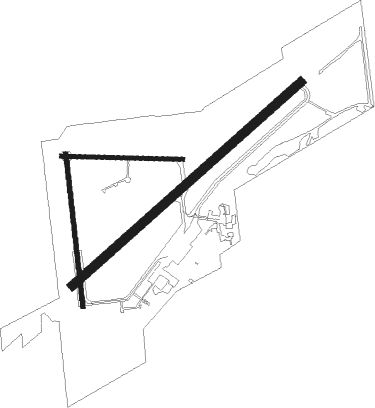
Runway info
Runway 11 / 29  | ||
| length | 606m (1988ft) | |
| bearing | 94° / 274° | |
| width | 23m (75ft) | |
| surface | asphalt | |
| Runway 06 / 24 | ||
| length | 1526m (5007ft) | |
| bearing | 61° / 241° | |
| width | 46m (150ft) | |
| surface | asphalt | |
| Runway 01 / 19 | ||
| length | 764m (2507ft) | |
| bearing | 357° / 177° | |
| width | 23m (75ft) | |
| surface | asphalt | |
Nearby beacons
| code | identifier | dist | bearing | frequency |
|---|---|---|---|---|
| SN | ST CATHARINES NDB | 4.5 | 242° | 408 |
| IAG | NIAGARA FALLS TACAN | 10.3 | 111° | 111 |
| IA | KATHI (NIAGRA FALLS) NDB | 15.4 | 104° | 329 |
| GB | PLAZZ (BUFFALO) NDB | 24.6 | 132° | 204 |
| BU | KLUMP (BUFFALO) NDB | 25.5 | 110° | 231 |
| TZ | GIBRALTAR POINT NDB | 26.9 | 333° | 257 |
| ZHM | BINBROOK (HAMILTON) NDB | 27.3 | 266° | 266 |
| BUF | BUFFALO VOR/DME | 27.9 | 117° | 116.40 |
| ZYZ | QUEENSWAY (TORONTO) NDB | 30.5 | 319° | 368 |
| YYZ | TORONTO VOR/DME | 34.4 | 315° | 112.15 |
| YTP | PEARSON (TORONTO) VOR/DME | 35.9 | 314° | 116.55 |
| HM | HAMILTON NDB | 36.8 | 265° | 221 |
| ZHA | ANCASTER (HAMILTON) NDB | 37.4 | 270° | 397 |
| ZTO | WOODHILL (TORONTO) NDB | 40.2 | 316° | 403 |
| DKK | DME | 42.3 | 188° | 116.20 |
| KZ | BUTTONVILLE NDB | 45 | 348° | 248 |
| OO | OSHAWA NDB | 45.3 | 20° | 391 |
| YO | DME-ILS | 45.3 | 21° | 111.35 |
| YMS | MANS (MANSFIELD) VOR/DME | 71.1 | 314° | 114.50 |
Instrument approach procedures
| runway | airway (heading) | route (dist, bearing) |
|---|---|---|
| RW06 | OTSIN (35°) | OTSIN PELPA (5mi, 314°) 2200ft |
| RW06 | UMAVU (81°) | UMAVU PELPA (5mi, 134°) 2200ft |
| RNAV | PELPA 2200ft UDNEM (6mi, 61°) 1700ft CYSN (5mi, 61°) 371ft (4932mi, 119°) 2300ft UMAVU (4943mi, 299°) 2300ft UMAVU (turn) | |
| RW24 | DUXIG (215°) | DUXIG LIRLU (5mi, 134°) 1700ft |
| RW24 | VOGES (261°) | VOGES LIRLU (5mi, 314°) 1700ft |
| RNAV | LIRLU 1700ft APNUS (6mi, 241°) 1700ft SEDUM (2mi, 241°) 940ft CYSN (2mi, 240°) 369ft IKLIR (5mi, 241°) 2200ft IKLIR (turn) |
Disclaimer
The information on this website is not for real aviation. Use this data with the X-Plane flight simulator only! Data taken with kind consent from X-Plane 12 source code and data files. Content is subject to change without notice.