Thompson
Airport details
| Country | Canada |
| State | Manitoba |
| Region | CY |
| Airspace | Winnipeg Ctr |
| Municipality | Local Government District of Mystery Lak |
| Elevation | 729ft (222m) |
| Timezone | GMT -6 |
| Coordinates | 55.80463, -97.86241 |
| Magnetic var | |
| Type | land |
| Available since | X-Plane v10.40 |
| ICAO code | CYTH |
| IATA code | YTH |
| FAA code | n/a |
Communication
| Thompson ATIS | 127.650 |
| Thompson FSS | 122.500 |
Approach frequencies
| ILS-cat-I | RW06 | 110.3 | 18.00mi |
| 3° GS | RW06 | 110.3 | 18.00mi |
Runway info
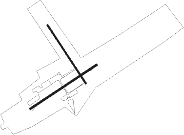
Runway 06 / 24  | ||
| length | 1769m (5804ft) | |
| bearing | 73° / 253° | |
| width | 46m (150ft) | |
| surface | asphalt | |
| blast zone | 8m (26ft) / 8m (26ft) | |
| Runway 15 / 33 | ||
| length | 1549m (5082ft) | |
| bearing | 135° / 315° | |
| width | 30m (100ft) | |
| surface | gravel | |
Nearby beacons
| code | identifier | dist | bearing | frequency |
|---|---|---|---|---|
| YTH | THOMPSON VOR/DME | 1.3 | 80° | 112.90 |
Departure and arrival routes
| Transition altitude | 18000ft |
| Transition level | 18000ft |
| SID end points | distance | outbound heading | |
|---|---|---|---|
| RW06 | |||
| CYTH3 | 51mi | 82° | |
| RW15 | |||
| CYTH3 | 51mi | 82° | |
| RW24 | |||
| CYTH3 | 51mi | 82° | |
| RW33 | |||
| CYTH3 | 51mi | 82° | |
Instrument approach procedures
| runway | airway (heading) | route (dist, bearing) |
|---|---|---|
| RW06 | PIBGU (87°) | PIBGU VIGDI (5mi, 135°) 2100ft |
| RW06 | SEVTO (51°) | SEVTO VIGDI (5mi, 315°) 2100ft |
| RNAV | VIGDI 2100ft ITLOP (6mi, 73°) 2100ft CYTH (5mi, 71°) 767ft MIDGA (4mi, 75°) 2400ft MIDGA (turn) 2400ft | |
| RW15 | VISUP (174°) | VISUP ALVIB (5mi, 253°) 2100ft |
| RW15 | VOBAV (112°) | VOBAV ALVIB (5mi, 73°) 2100ft |
| RNAV | ALVIB 2100ft ITMOL (6mi, 135°) 2100ft CYTH (5mi, 137°) 785ft VIDGU (4mi, 134°) 2400ft VIDGU (turn) | |
| RW24 | NAGBA (233°) | NAGBA LIVGO (5mi, 136°) 2100ft |
| RW24 | TANRA (269°) | TANRA LIVGO (5mi, 316°) 2100ft |
| RNAV | LIVGO 2100ft ROTRI (6mi, 253°) 2100ft CYTH (5mi, 255°) 766ft XEVAS (5mi, 251°) 2400ft XEVAS (turn) 2400ft | |
| RW33 | DUSIS (353°) | DUSIS SASEV (5mi, 73°) 2100ft |
| RW33 | NUDOL (292°) | NUDOL SASEV (5mi, 253°) 2100ft |
| RNAV | SASEV 2100ft BIVPO (6mi, 316°) 2100ft CYTH (5mi, 314°) 751ft MEDOP (5mi, 317°) 2400ft MEDOP (turn) |
Disclaimer
The information on this website is not for real aviation. Use this data with the X-Plane flight simulator only! Data taken with kind consent from X-Plane 12 source code and data files. Content is subject to change without notice.