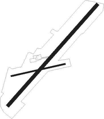
Trenton
Airport details
| Country | Canada |
| State | Nova Scotia |
| Region | CY |
| Airspace | Moncton Ctr |
| Municipality | Trenton |
| Elevation | 317ft (97m) |
| Timezone | GMT -4 |
| Coordinates | 45.61182, -62.62112 |
| Magnetic var | |
| Type | land |
| Available since | X-Plane v10.40 |
| ICAO code | CYTN |
| IATA code | n/a |
| FAA code | n/a |
Communication
| Trenton CTAF/UNICOM | 122.800 |
| Trenton MONCTON CNTR | 135.300 |
| Trenton MONCTON CNTR | 135.650 |
Nearby beacons
| code | identifier | dist | bearing | frequency |
|---|---|---|---|---|
| YYG | CHARLOTTETOWN VOR/DME | 46.1 | 324° | 113.80 |
| ZNS | BLUENOSE (HALIFAX) NDB | 51.5 | 231° | 385 |
| YHZ | HALIFAX VOR/DME | 52.9 | 229° | 115.10 |
| ZHZ | SPLIT CROW (HALIFAX) NDB | 63.5 | 230° | 364 |
| UAW | SHEARWATER (HALIFAX) TACAN | 69.5 | 222° | 110.10 |
Instrument approach procedures
| runway | airway (heading) | route (dist, bearing) |
|---|---|---|
| RW06 | OTANO (26°) | OTANO VOKEN (5mi, 306°) 2100ft |
| RW06 | SOOKE (78°) | SOOKE VOKEN (5mi, 126°) 2100ft |
| RNAV | VOKEN 2100ft XULPI (5mi, 56°) 2000ft ROVRA (3mi, 56°) 930ft CYTN (2mi, 56°) 351ft TEVOT (5mi, 56°) 2600ft TEVOT (turn) | |
| RW24 | JULAN (257°) | JULAN AGDUS (5mi, 306°) 1900ft |
| RW24 | LIDET (208°) | LIDET AGDUS (5mi, 126°) 1900ft |
| RNAV | AGDUS 1900ft DURUD (6mi, 236°) 1900ft CYTN (5mi, 236°) 303ft AGPEG (5mi, 236°) 2600ft AGPEG (turn) |
Disclaimer
The information on this website is not for real aviation. Use this data with the X-Plane flight simulator only! Data taken with kind consent from X-Plane 12 source code and data files. Content is subject to change without notice.

