Rouyn-noranda - Rouyn Noranda
Airport details
| Country | Canada |
| State | Quebec |
| Region | CY |
| Airspace | Montreal Ctr |
| Municipality | Rouyn-Noranda |
| Elevation | 984ft (300m) |
| Timezone | GMT -5 |
| Coordinates | 48.20619, -78.83559 |
| Magnetic var | |
| Type | land |
| Available since | X-Plane v10.40 |
| ICAO code | CYUY |
| IATA code | YUY |
| FAA code | n/a |
Communication
| Rouyn Noranda MF | 122.200 |
Approach frequencies
| LOC | RW08 | 109.9 | 18.00mi |
Nearby Points of Interest:
Dumulon's General Store
-Église Saint-Georges
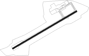
Runway info
| Runway 08 / 26 | ||
| length | 2281m (7484ft) | |
| bearing | 72° / 252° | |
| width | 46m (150ft) | |
| surface | asphalt | |
Nearby beacons
| code | identifier | dist | bearing | frequency |
|---|---|---|---|---|
| YUY | ROUYN NDB | 4.5 | 252° | 218 |
Departure and arrival routes
| Transition altitude | 18000ft |
| Transition level | 18000ft |
| SID end points | distance | outbound heading | |
|---|---|---|---|
| RW08 | |||
| KERNU3 | 31mi | 92° | |
| MUNBI4 | 22mi | 100° | |
| RW26 | |||
| KERNU3 | 31mi | 92° | |
| MUNBI4 | 22mi | 100° | |
Instrument approach procedures
| runway | airway (heading) | route (dist, bearing) |
|---|---|---|
| RW08 | EBDOG (319°) | EBDOG KAVEP (15mi, 274°) 3300ft SALCN (7mi, 324°) 2800ft |
| RW08 | GOVAT (191°) | GOVAT OMAXU (25mi, 228°) 4100ft SALCN (5mi, 144°) 2800ft |
| RNAV | SALCN 2800ft BETOK (6mi, 72°) 2600ft STALH (3mi, 72°) 1630ft CYUY (3mi, 72°) 1025ft METVU (9mi, 72°) 3600ft METVU (turn) | |
| RW26 | GOVAT (191°) | GOVAT NOSAP (12mi, 129°) 4100ft OVUNI (5mi, 144°) 3500ft |
| RW26 | REZIN (308°) | REZIN ILEKI (32mi, 334°) 3700ft OVUNI (5mi, 324°) 3500ft |
| RW26 | YVO (272°) | YVO OVUNI (29mi, 281°) 3500ft |
| RNAV | OVUNI 3500ft SIBNA (8mi, 252°) 2600ft XEXIT (2mi, 252°) 2000ft CYUY (4mi, 252°) 1041ft IKNOD (9mi, 252°) 3200ft IKNOD (turn) |
Disclaimer
The information on this website is not for real aviation. Use this data with the X-Plane flight simulator only! Data taken with kind consent from X-Plane 12 source code and data files. Content is subject to change without notice.