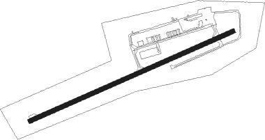
Vernon
Airport details
| Country | Canada |
| State | British Columbia |
| Region | CY |
| Airspace | Vancouver Ctr |
| Elevation | 1140ft (347m) |
| Timezone | GMT -8 |
| Coordinates | 50.24618, -119.33086 |
| Magnetic var | |
| Type | land |
| Available since | X-Plane v10.40 |
| ICAO code | CYVK |
| IATA code | YVE |
| FAA code | n/a |
Communication
| Vernon CTAF | 122.800 |
Nearby beacons
| code | identifier | dist | bearing | frequency |
|---|---|---|---|---|
| 6K | VERNON NDB | 6.8 | 34° | 302 |
| LW | KELOWNA NDB | 11.6 | 205° | 257 |
| EX | RUTLAND (KELOWNA) NDB | 18.4 | 188° | 374 |
| V6 | SALMON ARM NDB | 26.6 | 13° | 280 |
| YWB | WESTBANK (KELOWNA) NDB | 28.6 | 215° | 389 |
| YNY | DME | 29.9 | 42° | 115.20 |
| UNT | NARAMATA (PENTICTON) NDB | 40.3 | 203° | 312 |
| YYF | PENTICTON NDB | 46.7 | 200° | 290 |
| ON | OKANAGAN (PENTICTON) NDB | 55 | 195° | 356 |
Instrument approach procedures
| runway | airway (heading) | route (dist, bearing) |
|---|---|---|
| RW05 | YDC (50°) | YDC MUPNU (45mi, 56°) 8900ft AVSON (6mi, 16°) 5900ft |
| RNAV | AVSON 5900ft XEXON (3mi, 16°) 5900ft XIBUN (2mi, 16°) 5300ft RIBIV (turn) 5000ft UBTUL (3mi, 53°) 3900ft PEVKU (6mi, 53°) 1651ft VIGPI (20mi, 31°) 8000ft VIGPI (turn) | |
| RWNVB | BINVO (260°) | BINVO SEGIG (96mi, 264°) 13200ft EBMUL (6mi, 287°) 6400ft ALVED (6mi, 216°) 5500ft |
| RWNVB | VIDRI (89°) | VIDRI KEDOD (89mi, 81°) 8900ft EBMUL (6mi, 107°) 6400ft ALVED (6mi, 216°) 5500ft |
| RNAV | ALVED 5500ft OMEMA (4mi, 216°) 5100ft ILUDO (4mi, 216°) 3680ft MISAG (5mi, 216°) 3180ft (6500mi, 113°) 3900ft VIGBI (6493mi, 293°) 8000ft VIGBI (turn) |
Disclaimer
The information on this website is not for real aviation. Use this data with the X-Plane flight simulator only! Data taken with kind consent from X-Plane 12 source code and data files. Content is subject to change without notice.