Norman Wells
Airport details
| Country | Canada |
| State | Northwest Territories |
| Region | CY |
| Airspace | Edmonton Ctr |
| Municipality | Norman Wells |
| Elevation | 235ft (72m) |
| Timezone | GMT -7 |
| Coordinates | 65.28133, -126.79857 |
| Magnetic var | |
| Type | land |
| Available since | X-Plane v10.40 |
| ICAO code | CYVQ |
| IATA code | YVQ |
| FAA code | n/a |
Communication
| Norman Wells MF | 122.200 |
| Norman Wells EDMONTON CNTR | 134.825 |
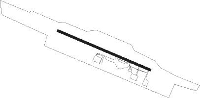
Runway info
| Runway 10 / 28 | ||
| length | 1825m (5988ft) | |
| bearing | 102° / 282° | |
| width | 46m (150ft) | |
| surface | asphalt | |
| displ threshold | 9m (30ft) / 9m (30ft) | |
Nearby beacons
| code | identifier | dist | bearing | frequency |
|---|---|---|---|---|
| YVQ | NORMAN WELLS VOR/DME | 2.1 | 102° | 112.70 |
| VQ | NORMAN WELLS NDB | 3.6 | 102° | 326 |
Instrument approach procedures
| runway | airway (heading) | route (dist, bearing) |
|---|---|---|
| RW10 | LIVMU (94°) | LIVMU VINPI (8mi, 82°) 3200ft |
| RW10 | ROPGA (102°) | ROPGA VINPI (8mi, 102°) 3200ft |
| RNAV | VINPI 3200ft USBAX (3mi, 102°) 2860ft SUSUT (3mi, 102°) 1900ft CYVQ (6mi, 102°) 287ft URLUB (3mi, 102°) DUNEK (9mi, 108°) 6100ft DUNEK (turn) | |
| RW28 | TOVIP (292°) | TOVIP RERER (7mi, 324°) 3600ft |
| RW28 | VIRMI (283°) | VIRMI RERER (11mi, 283°) 3600ft |
| RNAV | RERER 3600ft MUPUB (6mi, 283°) 1900ft RUBKU (4mi, 282°) 760ft CYVQ (2mi, 282°) 285ft BONEB (3mi, 282°) SENLI (9mi, 275°) 6100ft SENLI (turn) |
Disclaimer
The information on this website is not for real aviation. Use this data with the X-Plane flight simulator only! Data taken with kind consent from X-Plane 12 source code and data files. Content is subject to change without notice.