Prince George
Airport details
| Country | Canada |
| State | British Columbia |
| Region | CY |
| Airspace | Vancouver Ctr |
| Municipality | Prince George |
| Elevation | 2231ft (680m) |
| Timezone | GMT -8 |
| Coordinates | 53.88404, -122.67755 |
| Magnetic var | |
| Type | land |
| Available since | X-Plane v10.40 |
| ICAO code | CYXS |
| IATA code | YXS |
| FAA code | n/a |
Communication
| Prince George ATIS | 128.725 |
| Prince George Prince George Ground | 121.900 |
| Prince George Prince George Tower | 118.300 |
| Prince George Vancouver Approach | 133.800 |
| Prince George Vancouver Departure | 133.800 |
Approach frequencies
| ILS-cat-I | RW15 | 109.5 | 18.00mi |
| 3° GS | RW15 | 109.5 | 18.00mi |
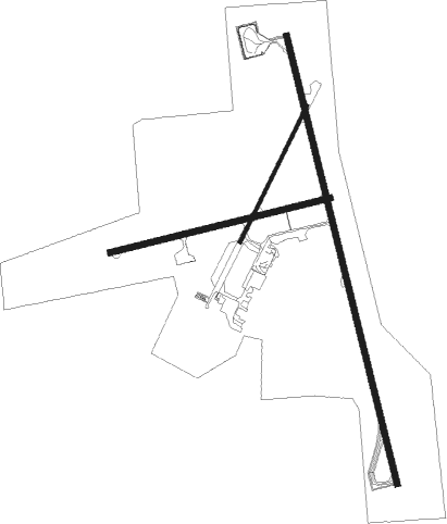
Runway info
Runway 15 / 33  | ||
| length | 3487m (11440ft) | |
| bearing | 164° / 344° | |
| width | 46m (151ft) | |
| surface | asphalt | |
| displ threshold | 0m (0ft) / 152m (499ft) | |
| Runway 06 / 24 | ||
| length | 1709m (5607ft) | |
| bearing | 84° / 264° | |
| width | 46m (150ft) | |
| surface | asphalt | |
| displ threshold | 0m (0ft) / 123m (404ft) | |
| Runway 01 / 19 | ||
| length | 1149m (3770ft) | |
| bearing | 45° / 225° | |
| width | 23m (75ft) | |
| surface | asphalt | |
| displ threshold | 303m (994ft) / 117m (384ft) | |
Nearby beacons
| code | identifier | dist | bearing | frequency |
|---|---|---|---|---|
| XS | PRINCE GEORGE NDB | 3.4 | 157° | 272 |
| ZXS | NORTHWOOD (PRINCE GEORGE) NDB | 5 | 352° | 260 |
| YXS | PRINCE GEORGE VOR/DME | 7.8 | 87° | 112.30 |
Instrument approach procedures
| runway | airway (heading) | route (dist, bearing) |
|---|---|---|
| RW06 | EMUDU (69°) | EMUDU MUXOV (5mi, 344°) 5200ft |
| RW06 | IKMUS (105°) | IKMUS MUXOV (8mi, 162°) 5200ft |
| RW06 | OLUDO (85°) | OLUDO MUXOV (5mi, 84°) 5200ft |
| RNAV | MUXOV 5200ft OMSED (5mi, 84°) 4500ft UMEPO (4mi, 84°) 3270ft CYXS (4mi, 86°) 2316ft (6520mi, 114°) 3000ft AXOMI (6515mi, 294°) 5300ft AXOMI (turn) | |
| RW15-Y | IKMUS (105°) | IKMUS 5600ft EPSIR (10mi, 84°) 5100ft BEPEX (4mi, 113°) 3700ft |
| RW15-Y | KESMU (267°) | KESMU 7600ft RERIN (6mi, 340°) 6500ft GORIK (4mi, 296°) 5300ft BEPEX (5mi, 236°) 3700ft |
| RW15-Y | OMSED (85°) | OMSED 7600ft XEROD (6mi, 13°) 6300ft EPSIR (4mi, 59°) 5100ft BEPEX (4mi, 113°) 3700ft |
| RW15-Y | ULEBU (256°) | ULEBU 7600ft GORIK (17mi, 271°) 5300ft BEPEX (5mi, 236°) 3700ft |
| RW15-Y | VOLES (167°) | VOLES 5500ft BEPEX (6mi, 164°) 3700ft |
| RNAV | BEPEX 3700ft CYXS (5mi, 171°) 2290ft NOXEL (9mi, 160°) 7000ft NOXEL (turn) | |
| RW15-Z | KINEV (207°) | KINEV VOLES (5mi, 264°) 4200ft |
| RW15-Z | OTUKU (133°) | OTUKU VOLES (5mi, 84°) 4200ft |
| RNAV | VOLES 4200ft BEPEX (6mi, 164°) 3700ft CYXS (5mi, 171°) 2290ft NOXEL (9mi, 160°) 7000ft NOXEL (turn) | |
| RW24 | UKSEK (262°) | UKSEK PUTUG (5mi, 306°) 6000ft |
| RW24 | VIPVU (233°) | VIPVU PUTUG (5mi, 126°) 6000ft |
| RNAV | PUTUG 6000ft ONDAV (7mi, 245°) 4400ft XUBEP (2mi, 255°) 3670ft XONSO (2mi, 255°) 2910ft SERMU (2mi, 255°) 2438ft VIXAD (10mi, 255°) 5400ft VIXAD (turn) 5400ft | |
| RW33-Y | EMPOV (342°) | EMPOV 7600ft BOSOK (6mi, 344°) 5700ft AXIGA (6mi, 344°) 3800ft |
| RW33-Y | URSIN (291°) | URSIN 7600ft JUNTY (8mi, 270°) 5100ft AXIGA (4mi, 297°) 3800ft |
| RNAV | AXIGA 3800ft CYXS (6mi, 338°) 2245ft ILITA (13mi, 347°) 7000ft ILITA (turn) | |
| RW33-Z | EBKAD (307°) | EBKAD BOSOK (6mi, 264°) 5200ft |
| RW33-Z | EMPOV (342°) | EMPOV BOSOK (6mi, 344°) 5200ft |
| RW33-Z | GOTET (26°) | GOTET BOSOK (6mi, 84°) 5200ft |
| RNAV | BOSOK 5200ft AXIGA (6mi, 344°) 3800ft CYXS (6mi, 338°) 2245ft ILITA (13mi, 347°) 7000ft ILITA (turn) |
Disclaimer
The information on this website is not for real aviation. Use this data with the X-Plane flight simulator only! Data taken with kind consent from X-Plane 12 source code and data files. Content is subject to change without notice.