Abbotsford
Airport details
| Country | Canada |
| State | British Columbia |
| Region | CY |
| Airspace | Vancouver Ctr |
| Municipality | Abbotsford |
| Elevation | 192ft (59m) |
| Timezone | GMT -8 |
| Coordinates | 49.02527, -122.35995 |
| Magnetic var | |
| Type | land |
| Available since | X-Plane v10.30 |
| ICAO code | CYXX |
| IATA code | YXX |
| FAA code | n/a |
Communication
| Abbotsford CYXX ATIS | 119.800 |
| Abbotsford ABBOTSFORD Ground Control | 121.800 |
| Abbotsford ABBOTSFORD Tower | 119.400 |
| Abbotsford VICTORIA TML | 132.700 |
Approach frequencies
| ILS-cat-I | RW07 | 109.7 | 18.00mi |
| 3° GS | RW07 | 109.7 | 18.00mi |
Nearby Points of Interest:
Fort Langley National Historic Site
-MV Plover
-Aftermath Clubhouse
-Lottie Roth Block
-T. G. Richards and Company Store
-United States Post Office and Courthouse
-B. P. O. E. Building
-Flatiron Building
-Bellingham National Bank Building
-J. J. Donovan House
-Old Main
-Gamwell House
-Lairmont Manor
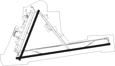
Runway info
Runway 07 / 25  | ||
| length | 2928m (9606ft) | |
| bearing | 87° / 267° | |
| width | 61m (200ft) | |
| surface | asphalt | |
| displ threshold | 0m (0ft) / 90m (295ft) | |
| Runway 01 / 19 | ||
| length | 1626m (5335ft) | |
| bearing | 36° / 216° | |
| width | 61m (200ft) | |
| surface | asphalt | |
Nearby beacons
| code | identifier | dist | bearing | frequency |
|---|---|---|---|---|
| XX | ABBOTSFORD NDB | 5 | 266° | 344 |
| HUH | WHATCOM VORTAC | 9.8 | 250° | 113 |
| WC | WHITE ROCK NDB | 15.4 | 267° | 332 |
| YPK | PITT MEADOWS VOR | 18 | 298° | 112.40 |
| VR | VANCOUVER NDB | 28.8 | 282° | 266 |
| YVR | VANCOUVER VOR/DME | 31.2 | 274° | 115.90 |
| BVS | SKAGIT/BAY VIEW (BURLINGTON) NDB | 33.5 | 186° | 240 |
| AP | ACTIVE PASS NDB | 37.7 | 261° | 378 |
| FHR | FRIDAY HARBOR NDB | 40.5 | 232° | 284 |
| NUW | WHIDBEY ISLAND (OAK HARBO TACAN | 41.9 | 204° | 113.80 |
| HE | HOPE NDB | 42.6 | 69° | 245 |
| CVV | PENN COVE VOR/DME | 49 | 205° | 117.20 |
| AW | WATON (ARLINGTON) NDB | 57.5 | 168° | 382 |
Departure and arrival routes
| Transition altitude | 18000ft |
| Transition level | 18000ft |
| SID end points | distance | outbound heading | |
|---|---|---|---|
| RW07 | |||
| GABVO4 | 20mi | 84° | |
| RW19 | |||
| GABVO4 | 20mi | 84° | |
| RW25 | |||
| GABVO4 | 20mi | 84° | |
| STAR starting points | distance | inbound heading | |
|---|---|---|---|
| ALL | |||
| MADEE4 | 40.8 | 3° | |
Instrument approach procedures
| runway | airway (heading) | route (dist, bearing) |
|---|---|---|
| RW07-Z | MISAR (86°) | MISAR 2000ft |
| RNAV | MISAR 2000ft LERIM (7mi, 87°) 2000ft AVASU (4mi, 87°) 820ft CYXX (3mi, 83°) 217ft (6639mi, 112°) 900ft VOKUB (6646mi, 292°) 3000ft HONUV (6mi, 279°) HONUV (turn) |
Holding patterns
| STAR name | hold at | type | turn | heading* | altitude | leg | speed limit |
|---|---|---|---|---|---|---|---|
| HE4 | OMINO | VHF | left | 69 (249)° | 1.0min timed | 210 | |
| *) magnetic outbound (inbound) holding course | |||||||
Disclaimer
The information on this website is not for real aviation. Use this data with the X-Plane flight simulator only! Data taken with kind consent from X-Plane 12 source code and data files. Content is subject to change without notice.