Whitehorse - Whitehorse/erik Nielsen Intl
Airport details
| Country | Canada |
| State | Yukon |
| Region | CY |
| Airspace | Edmonton Ctr |
| Municipality | Whitehorse |
| Elevation | 2315ft (706m) |
| Timezone | GMT -8 |
| Coordinates | 60.71282, -135.07414 |
| Magnetic var | |
| Type | land |
| Available since | X-Plane v10.40 |
| ICAO code | CYXY |
| IATA code | YXY |
| FAA code | n/a |
Communication
| Whitehorse/Erik Nielsen Intl ATIS | 125.250 |
| Whitehorse/Erik Nielsen Intl MANDATORY FREQ | 118.300 |
| Whitehorse/Erik Nielsen Intl Ground Control | 121.900 |
| Whitehorse/Erik Nielsen Intl Tower | 118.300 |
| Whitehorse/Erik Nielsen Intl Approach/Departure | 134.150 |
Approach frequencies
| ILS-cat-I | RW32L | 109.5 | 18.00mi |
| 3° GS | RW32L | 109.5 | 18.00mi |
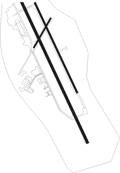
Runway info
Runway 14R / 32L  | ||
| length | 2897m (9505ft) | |
| bearing | 142° / 322° | |
| width | 46m (150ft) | |
| surface | asphalt | |
| displ threshold | 259m (850ft) / 427m (1401ft) | |
| Runway 14L / 32R | ||
| length | 1622m (5322ft) | |
| bearing | 142° / 322° | |
| width | 30m (100ft) | |
| surface | asphalt | |
| displ threshold | 0m (0ft) / 396m (1299ft) | |
| Runway 02 / 20 | ||
| length | 549m (1801ft) | |
| bearing | 54° / 234° | |
| width | 23m (75ft) | |
| surface | asphalt | |
Nearby beacons
| code | identifier | dist | bearing | frequency |
|---|---|---|---|---|
| ZXY | KLONDIKE (WHITEHORSE) NDB | 4.9 | 140° | 353 |
| YXY | WHITEHORSE VOR/DME | 5.9 | 215° | 116.60 |
| JB | LABERGE (WHITEHORSE) NDB | 14.3 | 345° | 236 |
| PJ | ROBINSON (WHITEHORSE) NDB | 17.5 | 142° | 329 |
Instrument approach procedures
| runway | airway (heading) | route (dist, bearing) |
|---|---|---|
| RW14R | EPNOK (113°) | EPNOK OVUMA (6mi, 79°) 5300ft |
| RW14R | IMISA (196°) | IMISA OVUMA (6mi, 260°) 5300ft |
| RNAV | OVUMA 5300ft SINDU (5mi, 142°) 4000ft CYXY (6mi, 144°) 2325ft (6622mi, 114°) 3200ft LEVEP (6624mi, 294°) DUNDU (14mi, 94°) 7700ft DUNDU (turn) | |
| RW32L | IKNEP (353°) | IKNEP KESNO (5mi, 79°) 7000ft |
| RW32L | KEMGI (308°) | KEMGI IGTID (3mi, 289°) 7700ft KESNO (5mi, 289°) 7000ft |
| RNAV | KESNO 7000ft MIXUM (6mi, 323°) 5200ft PIVUX (5mi, 323°) 3500ft CYXY (4mi, 320°) 2357ft TESOG (3mi, 326°) ULUKA (19mi, 1°) 7600ft ULUKA (turn) |
Disclaimer
The information on this website is not for real aviation. Use this data with the X-Plane flight simulator only! Data taken with kind consent from X-Plane 12 source code and data files. Content is subject to change without notice.