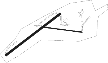
Fort Nelson
Airport details
| Country | Canada |
| State | British Columbia |
| Region | CY |
| Airspace | Edmonton Ctr |
| Municipality | Northern Rockies Regional Municipality |
| Elevation | 1250ft (381m) |
| Timezone | GMT -8 |
| Coordinates | 58.83640, -122.59698 |
| Magnetic var | |
| Type | land |
| Available since | X-Plane v10.40 |
| ICAO code | CYYE |
| IATA code | YYE |
| FAA code | n/a |
Communication
| FORT NELSON MF NELSON RDO | 122.200 |
Approach frequencies
| ILS-cat-I | RW04 | 110.3 | 18.00mi |
| 3° GS | RW04 | 110.3 | 18.00mi |
Nearby beacons
| code | identifier | dist | bearing | frequency |
|---|---|---|---|---|
| YE | FORT NELSON NDB | 4.6 | 252° | 382 |
| YYE | FORT NELSON VOR/DME | 13.4 | 278° | 112.90 |
Instrument approach procedures
| runway | airway (heading) | route (dist, bearing) |
|---|---|---|
| RW04 | DEMLI (52°) | DEMLI NAGOT (5mi, 320°) 2800ft |
| RW04 | IKLAS (86°) | IKLAS NAGOT (5mi, 128°) 2800ft |
| RNAV | NAGOT 2800ft SEPNO (6mi, 71°) 2600ft TALAT (1mi, 71°) 2170ft CYYE (3mi, 72°) 1310ft VERLA (7mi, 71°) 3900ft VERLA (turn) | |
| RW22 | AGLAR (266°) | AGLAR KATAM (5mi, 309°) 2900ft |
| RW22 | BINSA (229°) | BINSA KATAM (5mi, 129°) 2900ft |
| RNAV | KATAM 2900ft MAXIP (5mi, 251°) 2900ft CYYE (5mi, 251°) 1297ft RIBAT (8mi, 252°) 5600ft RIBAT (turn) |
Disclaimer
The information on this website is not for real aviation. Use this data with the X-Plane flight simulator only! Data taken with kind consent from X-Plane 12 source code and data files. Content is subject to change without notice.

