Charlottetown
Airport details
| Country | Canada |
| State | Prince Edward Island |
| Region | CY |
| Airspace | Moncton Ctr |
| Municipality | Charlottetown |
| Elevation | 151ft (46m) |
| Timezone | GMT -4 |
| Coordinates | 46.28915, -63.11925 |
| Magnetic var | |
| Type | land |
| Available since | X-Plane v10.40 |
| ICAO code | CYYG |
| IATA code | YYG |
| FAA code | CYYG |
Communication
| Charlottetown CYYG CONTROL | 122.500 |
| Charlottetown CYYG TOWER | 126.800 |
Approach frequencies
| ILS-cat-I | RW03 | 110.9 | 18.00mi |
| 3° GS | RW03 | 110.9 | 18.00mi |
Nearby Points of Interest:
All Souls' Chapel
-Dalvay-by-the-Sea
-Green Gables
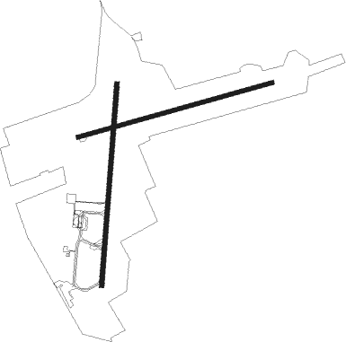
Runway info
Runway 03 / 21  | ||
| length | 2134m (7001ft) | |
| bearing | 13° / 193° | |
| width | 46m (151ft) | |
| surface | concrete | |
| blast zone | 43m (141ft) / 0m (0ft) | |
| Runway 10 / 28 | ||
| length | 2127m (6978ft) | |
| bearing | 82° / 262° | |
| width | 46m (150ft) | |
| surface | concrete | |
| blast zone | 150m (492ft) / 11m (36ft) | |
Nearby beacons
| code | identifier | dist | bearing | frequency |
|---|---|---|---|---|
| YYG | CHARLOTTETOWN VOR/DME | 0.5 | 357° | 113.80 |
| 5B | SUMMERSIDE NDB | 32.2 | 278° | 254 |
Instrument approach procedures
| runway | airway (heading) | route (dist, bearing) |
|---|---|---|
| RW03-Y | KESVU (288°) | KESVU 5000ft SUXAG (7mi, 259°) 2700ft URTEP (4mi, 302°) 1200ft |
| RW03-Y | LENUG (67°) | LENUG 5000ft UDBIK (9mi, 82°) 2100ft URTEP (3mi, 54°) 1200ft |
| RW03-Y | VILRI (14°) | VILRI 3000ft URTEP (8mi, 13°) 1200ft |
| RNAV | URTEP 1200ft CYYG (4mi, 18°) 208ft OTETI (11mi, 11°) 3000ft OTETI (turn) | |
| RW03-Z | UKOBO (44°) | UKOBO VILRI (5mi, 96°) 2000ft |
| RW03-Z | VIKBO (340°) | VIKBO VILRI (5mi, 276°) 2000ft |
| RNAV | VILRI 2000ft IKMAD (5mi, 13°) 2000ft CYYG (6mi, 16°) 208ft OTETI (11mi, 11°) 3000ft OTETI (turn) 3000ft | |
| RW10-Y | LOBDA (44°) | LOBDA 5000ft URVUL (9mi, 19°) 2100ft SIPDI (3mi, 56°) 1200ft |
| RW10-Y | PEVMU (181°) | PEVMU 5000ft OTPEP (4mi, 262°) 3600ft SIPDI (5mi, 164°) 1200ft |
| RW10-Y | ROGDO (84°) | ROGDO 3000ft SIPDI (7mi, 82°) 1200ft |
| RNAV | SIPDI 1200ft CYYG (3mi, 86°) 208ft EPLUN (10mi, 81°) 3000ft EPLUN (turn) | |
| RW10-Z | HALIO (64°) | HALIO ROGDO (5mi, 344°) 2100ft |
| RW10-Z | IKNOX (101°) | IKNOX ROGDO (5mi, 164°) 2100ft |
| RNAV | ROGDO 2100ft TIMAT (6mi, 82°) 1500ft CYYG (4mi, 85°) 208ft EPLUN (10mi, 81°) 3000ft EPLUN (turn) 3000ft | |
| RW21-Y | ITMED (245°) | ITMED 5000ft VIVOP (9mi, 261°) 2100ft SESKU (3mi, 233°) 1200ft |
| RW21-Y | LIBIG (108°) | LIBIG 5000ft DEPDU (7mi, 80°) 2700ft SESKU (4mi, 122°) 1200ft |
| RW21-Y | OBNAT (284°) | OBNAT 5000ft VOLIL (5mi, 13°) 3600ft VIVOP (4mi, 303°) 2100ft SESKU (3mi, 233°) 1200ft |
| RW21-Y | OTETI (191°) | OTETI 3000ft SESKU (7mi, 193°) 1200ft |
| RW21-Y | VOKEM (89°) | VOKEM 5000ft IKNUP (5mi, 13°) 3600ft DEPDU (3mi, 53°) 2700ft SESKU (4mi, 122°) 1200ft |
| RNAV | SESKU 1200ft CYYG (4mi, 187°) 211ft VILRI (11mi, 194°) 3000ft VILRI (turn) | |
| RW21-Z | OVAPU (156°) | OVAPU OTETI (5mi, 96°) 2000ft |
| RW21-Z | XUBTO (223°) | XUBTO OTETI (5mi, 276°) 2000ft |
| RNAV | OTETI 2000ft XOVAT (6mi, 193°) 1500ft CYYG (5mi, 188°) 211ft VILRI (11mi, 194°) 3000ft VILRI (turn) 3000ft | |
| RW28-Y | EPLUN (261°) | EPLUN 3000ft TIBUB (6mi, 262°) 1200ft |
| RW28-Y | MEDBO (319°) | MEDBO 5000ft OVOMI (7mi, 13°) 2700ft TIBUB (4mi, 304°) 1200ft |
| RW28-Y | NOVOD (154°) | NOVOD 5000ft VOMAM (4mi, 82°) 3600ft TIBUB (5mi, 164°) 1200ft |
| RW28-Y | URNID (351°) | URNID 5000ft ITKIR (5mi, 71°) 3400ft OVOMI (2mi, 47°) 2700ft TIBUB (4mi, 304°) 1200ft |
| RNAV | TIBUB 1200ft CYYG (4mi, 258°) 217ft ROGDO (10mi, 264°) 3000ft ROGDO (turn) | |
| RW28-Z | ONBOV (280°) | ONBOV EPLUN (5mi, 344°) 1500ft |
| RW28-Z | VIXUL (240°) | VIXUL EPLUN (5mi, 164°) 1500ft |
| RNAV | EPLUN 1500ft DUVEK (5mi, 262°) 1500ft CYYG (5mi, 259°) 217ft ROGDO (10mi, 264°) 3000ft ROGDO (turn) 3000ft |
Disclaimer
The information on this website is not for real aviation. Use this data with the X-Plane flight simulator only! Data taken with kind consent from X-Plane 12 source code and data files. Content is subject to change without notice.