Toronto - Downsview
Airport details
| Country | Canada |
| State | Ontario |
| Region | CY |
| Airspace | Toronto Ctr |
| Municipality | Toronto |
| Elevation | 649ft (198m) |
| Timezone | GMT -5 |
| Coordinates | 43.74266, -79.46564 |
| Magnetic var | |
| Type | land |
| Available since | X-Plane v10.40 |
| ICAO code | CYZD |
| IATA code | YZD |
| FAA code | n/a |
Communication
| Downsview MF/UNICOM | 126.200 |
| Downsview TORONTO TRML | 133.400 |
Nearby Points of Interest:
Government of Canada Building
-Deer Park United Church
-Avenue Road Church
-Masonic Temple
-John Daniels' House
-University Theatre
-Runnymede Theatre
-Hart House
-St. Basil's Church
-University College
-College Street Baptist Church
-James Cooper House
-Koffler Student Centre
-Women's College Hospital
-IOOF Hall
-Maple Leaf Gardens
-Standard Theatre
-Arts and Letters Club of Toronto
-Empress Hotel
-Canada Life Building
-Osgoode Hall
-299 Queen Street West
-205 Yonge Street
-Walnut Hall
-John Cox Cottage
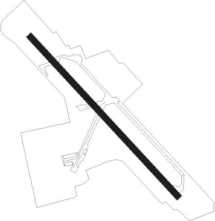
Runway info
| Runway 15 / 33 | ||
| length | 2134m (7001ft) | |
| bearing | 132° / 312° | |
| width | 61m (200ft) | |
| surface | asphalt | |
| blast zone | 12m (39ft) / 6m (20ft) | |
Nearby beacons
| code | identifier | dist | bearing | frequency |
|---|---|---|---|---|
| ZYZ | QUEENSWAY (TORONTO) NDB | 8.2 | 214° | 368 |
| TZ | GIBRALTAR POINT NDB | 8.5 | 148° | 257 |
| YYZ | TORONTO VOR/DME | 8.8 | 243° | 112.15 |
| YTP | PEARSON (TORONTO) VOR/DME | 9.6 | 250° | 116.55 |
| ZTO | WOODHILL (TORONTO) NDB | 10.3 | 269° | 403 |
| KZ | BUTTONVILLE NDB | 12.8 | 36° | 248 |
| OO | OSHAWA NDB | 26.7 | 73° | 391 |
| YO | DME-ILS | 27.2 | 73° | 111.35 |
| YSO | DME | 32.3 | 31° | 117.35 |
| SN | ST CATHARINES NDB | 36.9 | 161° | 408 |
| YMS | MANS (MANSFIELD) VOR/DME | 38 | 300° | 114.50 |
| ZHM | BINBROOK (HAMILTON) NDB | 38.6 | 209° | 266 |
| ZKF | WELLINGTON (KITCHENER) NDB | 38.7 | 253° | 335 |
| ZHA | ANCASTER (HAMILTON) NDB | 40.9 | 226° | 397 |
| WT | (KITCHENER) DME | 43.2 | 253° | 115 |
| IAG | NIAGARA FALLS TACAN | 43.7 | 141° | 111 |
| HM | HAMILTON NDB | 44.1 | 221° | 221 |
| IA | KATHI (NIAGRA FALLS) NDB | 46.8 | 135° | 329 |
| YEE | MIDLAND VOR/DME | 52.3 | 339° | 112.80 |
| BU | KLUMP (BUFFALO) NDB | 57 | 132° | 231 |
| FD | BRANTFORD NDB | 57.7 | 235° | 207 |
| GB | PLAZZ (BUFFALO) NDB | 59.3 | 143° | 204 |
| BUF | BUFFALO VOR/DME | 60.5 | 135° | 116.40 |
Instrument approach procedures
| runway | airway (heading) | route (dist, bearing) |
|---|---|---|
| RW15-Y | KEVLI (118°) | KEVLI IGSIK (6mi, 98°) 2100ft |
| RW15-Y | ODKEL (172°) | ODKEL IGSIK (6mi, 240°) 2500ft |
| RNAV | IGSIK 2100ft APLIT (6mi, 132°) 1800ft CYZD (4mi, 132°) 699ft AVTUM (3mi, 132°) 2400ft OMRUG (7mi, 98°) TESUK (22mi, 69°) TESUK (turn) | |
| RW15-Z | ADREB (127°) | ADREB DAROG (8mi, 114°) 2400ft |
| RNAV | DAROG 2400ft MIDPA (5mi, 137°) 2390ft TUDAS (2mi, 138°) 1590ft CYZD (3mi, 137°) 699ft IKDOP (3mi, 139°) KENDI (19mi, 91°) 2400ft KENDI (turn) | |
| RW33-Y | DUPIR (345°) | DUPIR PEMRO (6mi, 60°) 3000ft |
| RW33-Y | LENOB (288°) | LENOB PEMRO (6mi, 240°) 3000ft |
| RNAV | PEMRO 3000ft KOBIV (5mi, 313°) 3000ft CYZD (8mi, 312°) 686ft (4949mi, 119°) 1100ft LONTO (4944mi, 299°) 2500ft TESUK (22mi, 95°) TESUK (turn) | |
| RW33-Z | ELTOT (270°) | ELTOT GUBAL (6mi, 236°) 3000ft |
| RW33-Z | OLIGI (296°) | OLIGI GUBAL (11mi, 303°) 3000ft |
| RNAV | GUBAL 3000ft SEGID (5mi, 281°) 2000ft LORLI (2mi, 294°) 1620ft LESUS (1mi, 294°) 1190ft LONTO (12mi, 32°) 2500ft TESUK (22mi, 95°) TESUK (turn) |
Disclaimer
The information on this website is not for real aviation. Use this data with the X-Plane flight simulator only! Data taken with kind consent from X-Plane 12 source code and data files. Content is subject to change without notice.