Port Hardy
Airport details
| Country | Canada |
| State | British Columbia |
| Region | CY |
| Airspace | Vancouver Ctr |
| Municipality | Port Hardy |
| Elevation | 69ft (21m) |
| Timezone | GMT -8 |
| Coordinates | 50.68060, -127.36666 |
| Magnetic var | |
| Type | land |
| Available since | X-Plane v10.40 |
| ICAO code | CYZT |
| IATA code | YZT |
| FAA code | n/a |
Communication
| Port Hardy MF HARDY RDO | 122.200 |
Approach frequencies
| ILS-cat-I | RW11 | 109.5 | 18.00mi |
| 3.2° GS | RW11 | 109.5 | 18.00mi |
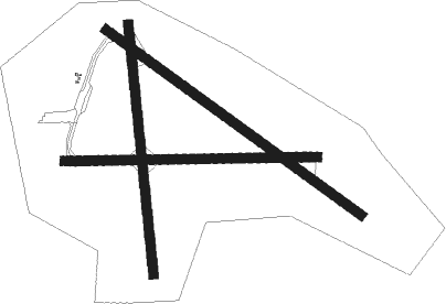
Runway info
Runway 11 / 29  | ||
| length | 1525m (5003ft) | |
| bearing | 118° / 298° | |
| width | 46m (150ft) | |
| surface | asphalt | |
| Runway 16 / 34 | ||
| length | 1215m (3986ft) | |
| bearing | 178° / 358° | |
| width | 46m (150ft) | |
| surface | asphalt | |
| blast zone | 80m (262ft) / 0m (0ft) | |
| Runway 08 / 26 | ||
| length | 1220m (4003ft) | |
| bearing | 92° / 272° | |
| width | 46m (150ft) | |
| surface | asphalt | |
Nearby beacons
| code | identifier | dist | bearing | frequency |
|---|---|---|---|---|
| YZT | PORT HARDY VOR/DME | 0.2 | 21° | 112 |
| ZT | PORT HARDY NDB | 2.5 | 287° | 242 |
Instrument approach procedures
| runway | airway (heading) | route (dist, bearing) |
|---|---|---|
| RW08-Y | AVSAS (109°) | AVSAS DUREX (7mi, 185°) 3500ft |
| RNAV | DUREX 3500ft ELOPI (5mi, 92°) 3100ft IMALA (3mi, 92°) 2300ft CYZT (7mi, 92°) 121ft MIPOS (10mi, 92°) 2800ft MIPOS (turn) | |
| RW08-Z | ELTIR (123°) | ELTIR IRDUT (7mi, 207°) 3000ft |
| RNAV | IRDUT 3000ft KAROP (5mi, 102°) 2500ft MIPUN (3mi, 102°) 1550ft PUSOL (4mi, 102°) 278ft OBNEN (4mi, 102°) MIPOS (7mi, 87°) 2800ft MIPOS (turn) | |
| RW11 | BEVAG (141°) | BEVAG IGTIV (5mi, 233°) 3500ft |
| RW11 | GAGBA (118°) | GAGBA IGTIV (5mi, 118°) 3500ft |
| RNAV | IGTIV 3500ft LIBIT (7mi, 118°) 1900ft TATPI (3mi, 118°) 1000ft CYZT (3mi, 120°) 99ft TABED (4mi, 117°) PIKTA (8mi, 71°) 2800ft PIKTA (turn) | |
| RW26-Y | CORMO (290°) | CORMO SIBKA (8mi, 324°) 3100ft |
| RW26-Y | ONBIS (257°) | ONBIS SIBKA (5mi, 186°) 3100ft |
| RNAV | SIBKA 3100ft PUXUM (6mi, 272°) 1700ft KEDPO (4mi, 272°) 401ft (6762mi, 112°) 700ft VEVTO (6763mi, 292°) 2800ft VEVTO (turn) | |
| RW26-Z | CORMO (290°) | CORMO SIBKA (8mi, 324°) 3100ft |
| RW26-Z | ONBIS (257°) | ONBIS SIBKA (5mi, 186°) 3100ft |
| RNAV | SIBKA 3100ft PUXUM (6mi, 272°) 1700ft KEDPO (4mi, 272°) 401ft (6762mi, 112°) 700ft VEVTO (6763mi, 292°) 2800ft VEVTO (turn) | |
| RW29 | CORMO (290°) | CORMO ADSOS (5mi, 281°) 3300ft |
| RW29 | TETAV (272°) | TETAV ADSOS (7mi, 221°) 3300ft |
| RNAV | ADSOS 3300ft DATKU (5mi, 289°) 2100ft KEGRO (4mi, 298°) 940ft CYZT (3mi, 297°) 85ft UKNAL (3mi, 300°) VEVTO (9mi, 326°) 2800ft VEVTO (turn) |
Disclaimer
The information on this website is not for real aviation. Use this data with the X-Plane flight simulator only! Data taken with kind consent from X-Plane 12 source code and data files. Content is subject to change without notice.