Greenwood
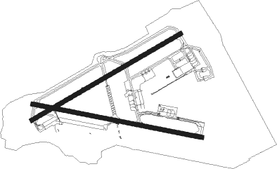
Airport details
| Country | Canada |
| State | Nova Scotia |
| Region | CY |
| Airspace | Moncton Ctr |
| Municipality | CFB Greenwood |
| Elevation | 83ft (25m) |
| Timezone | GMT -4 |
| Coordinates | 44.98097, -64.91362 |
| Magnetic var | |
| Type | land |
| Available since | X-Plane v10.40 |
| ICAO code | CYZX |
| IATA code | YZX |
| FAA code | n/a |
Communication
| Greenwood ATIS | 128.850 |
| Greenwood Clearance DEL | 128.025 |
| Greenwood Ground Control | 133.750 |
| Greenwood Tower | 119.500 |
| Greenwood Departure | 120.600 |
Approach frequencies
| ILS-cat-I | RW26 | 110.7 | 18.00mi |
| 3° GS | RW26 | 110.7 | 18.00mi |
Nearby Points of Interest:
Mount Hanley Schoolhouse Museum
-Charles Macdonald Concrete House Museum
-Hampton Lighthouse
-Grand-Pré
-Covenanter Church, Grand Pré, Nova Scotia

Nearby beacons
| code | identifier | dist | bearing | frequency |
|---|---|---|---|---|
| UZX | GREENWOOD TACAN | 0.2 | 292° | 117.60 |
| GF | AYLESFORD (GREENWOOD) NDB | 5 | 67° | 341 |
| YZX | GREENWOOD NDB | 8.7 | 253° | 266 |
| SJ | SAINT JOHN NDB | 45.5 | 294° | 212 |
| YSJ | SAINT JOHN VOR/DME | 47.9 | 294° | 113.50 |
Instrument approach procedures
| runway | airway (heading) | route (dist, bearing) |
|---|---|---|
| RW08 | TATMI (42°) | TATMI TUBIX (7mi, 326°) 2300ft |
| RW08 | TOTUD (72°) | TOTUD TUBIX (5mi, 71°) 2300ft |
| RW08 | TOVUK (96°) | TOVUK TUBIX (7mi, 146°) 2300ft |
| RNAV | TUBIX 2300ft TATVU (5mi, 71°) 1730ft CYZX (6mi, 74°) 135ft TASTU (8mi, 69°) 2500ft TASTU (turn) | |
| RW12 | OTUPI (91°) | OTUPI RONTI (5mi, 90°) 2100ft |
| RW12 | PILDI (109°) | PILDI RONTI (5mi, 180°) 2100ft |
| RW12 | ROKTU (73°) | ROKTU RONTI (5mi, 0°) 2100ft |
| RNAV | RONTI 2100ft SENVO (5mi, 90°) 1990ft RORPU (3mi, 90°) 950ft CYZX (3mi, 92°) 131ft DUMVO (8mi, 90°) 2500ft DUMVO (turn) | |
| RW26 | SIDBU (219°) | SIDBU TARNI (7mi, 146°) 2200ft |
| RW26 | SUTSI (269°) | SUTSI TARNI (5mi, 326°) 2200ft |
| RW26 | SUVAV (250°) | SUVAV TARNI (5mi, 251°) 2200ft |
| RNAV | TARNI 2200ft TASLA (5mi, 251°) 1730ft CYZX (6mi, 248°) 137ft SESTU (8mi, 253°) 2500ft SESTU (turn) | |
| RW30 | DUPGI (290°) | DUPGI RIKOB (5mi, 1°) 2300ft |
| RW30 | PIKRI (252°) | PIKRI RIKOB (5mi, 181°) 2300ft |
| RW30 | PUTIL (271°) | PUTIL RIKOB (5mi, 271°) 2300ft |
| RNAV | RIKOB 2300ft DUNEN (5mi, 270°) 1700ft PIDPA (3mi, 270°) 960ft CYZX (3mi, 273°) 141ft PIGSU (9mi, 269°) 2500ft PIGSU (turn) |
Disclaimer
The information on this website is not for real aviation. Use this data with the X-Plane flight simulator only! Data taken with kind consent from X-Plane 12 source code and data files. Content is subject to change without notice.