Burlington - Burlington Airpark
Airport details
| Country | Canada |
| State | Ontario |
| Region | CY |
| Airspace | Toronto Ctr |
| Municipality | Burlington |
| Elevation | 602ft (183m) |
| Timezone | GMT -5 |
| Coordinates | 43.44195, -79.84944 |
| Magnetic var | |
| Type | land |
| Available since | X-Plane v10.40 |
| ICAO code | CZBA |
| IATA code | n/a |
| FAA code | n/a |
Communication
| Burlington Airpark CTAF/UNICOM | 123.500 |
| Burlington Airpark TORONTO CNTR | 119.300 |
Nearby Points of Interest:
Crawford Lake Conservation Area
-Burlington Heights
-Former Hamilton Customs House
-Victoria Hall
-Hamilton City Hall
-Hamilton Waterworks
-Erland Lee Museum
-Runnymede Theatre
-Galt railway station
-Horticulture Building
-Liberty Grand Building
-Automotive Building
-Horse Palace
-Fort York Armoury
-College Street Baptist Church
-Standard Theatre
-299 Queen Street West
-Koffler Student Centre
-Canada Life Building
-The Toronto Club
-University College
-Osgoode Hall
-Toronto-Dominion Centre
-Hart House
-Canada Permanent Trust Building
Runway info
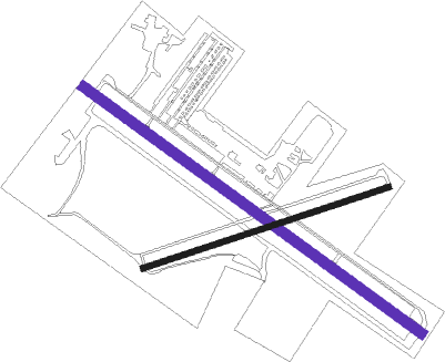
| Runway 14 / 32 | ||
| length | 1203m (3947ft) | |
| bearing | 122° / 302° | |
| width | 30m (100ft) | |
| surface | asphalt | |
| displ threshold | 57m (187ft) / 127m (417ft) | |
Runway 09 / 27  | ||
| length | 744m (2441ft) | |
| bearing | 80° / 260° | |
| width | 15m (50ft) | |
| surface | asphalt | |
| displ threshold | 101m (331ft) / 76m (249ft) | |
Nearby beacons
| code | identifier | dist | bearing | frequency |
|---|---|---|---|---|
| YTP | PEARSON (TORONTO) VOR/DME | 15.9 | 39° | 116.55 |
| YYZ | TORONTO VOR/DME | 16 | 45° | 112.15 |
| ZHA | ANCASTER (HAMILTON) NDB | 16.6 | 216° | 397 |
| ZYZ | QUEENSWAY (TORONTO) NDB | 16.9 | 60° | 368 |
| ZHM | BINBROOK (HAMILTON) NDB | 18 | 169° | 266 |
| ZTO | WOODHILL (TORONTO) NDB | 18.9 | 26° | 403 |
| ZKF | WELLINGTON (KITCHENER) NDB | 19.3 | 277° | 335 |
| HM | HAMILTON NDB | 20.4 | 206° | 221 |
| TZ | GIBRALTAR POINT NDB | 22.6 | 70° | 257 |
| WT | (KITCHENER) DME | 23.1 | 272° | 115 |
| SN | ST CATHARINES NDB | 31.4 | 116° | 408 |
| FD | BRANTFORD NDB | 33.2 | 237° | 207 |
| KZ | BUTTONVILLE NDB | 37.1 | 47° | 248 |
| IAG | NIAGARA FALLS TACAN | 43.6 | 110° | 111 |
| YMS | MANS (MANSFIELD) VOR/DME | 44 | 337° | 114.50 |
| OO | OSHAWA NDB | 50.2 | 63° | 391 |
| YO | DME-ILS | 50.7 | 64° | 111.35 |
| YSO | DME | 56.1 | 40° | 117.35 |
| DKK | DME | 62.4 | 149° | 116.20 |
Departure and arrival routes
| Transition altitude | 18000ft |
| Transition level | 18000ft |
| SID end points | distance | outbound heading | |
|---|---|---|---|
| RW14 | |||
| MAVAN2 | 57mi | 115° | |
| DUSOM2 | 173mi | 144° | |
| OAKVL2 | 138mi | 196° | |
| PEMBA6 | 102mi | 244° | |
| RW32 | |||
| MAVAN2 | 57mi | 115° | |
| DUSOM2 | 173mi | 144° | |
| OAKVL2 | 138mi | 196° | |
| PEMBA6 | 102mi | 244° | |
Instrument approach procedures
| runway | airway (heading) | route (dist, bearing) |
|---|---|---|
| RW32 | MESNO (277°) | MESNO BOXAN (5mi, 230°) 2600ft |
| RNAV | BOXAN 2600ft VIKTO (5mi, 302°) 1590ft CZBA (3mi, 303°) 631ft (4964mi, 119°) 1010ft MESNO (4954mi, 299°) 2600ft MESNO (turn) |
Disclaimer
The information on this website is not for real aviation. Use this data with the X-Plane flight simulator only! Data taken with kind consent from X-Plane 12 source code and data files. Content is subject to change without notice.