Vancouver - Boundary Bay
Airport details
| Country | Canada |
| State | British Columbia |
| Region | CY |
| Airspace | Vancouver Ctr |
| Municipality | Delta |
| Elevation | 3ft (1m) |
| Timezone | GMT -8 |
| Coordinates | 49.07940, -123.01807 |
| Magnetic var | |
| Type | land |
| Available since | X-Plane v10.40 |
| ICAO code | CZBB |
| IATA code | YDT |
| FAA code | n/a |
Communication
| Boundary Bay CZBB ATIS | 125.500 |
| Boundary Bay CZBB Ground | 124.300 |
| Boundary Bay CZBB Tower | 118.100 |
Nearby Points of Interest:
Great Marpole Midden
-MV Plover
-Bessborough Armoury
-Seaforth Armoury
-Carnegie Community Centre
-Sam Kee Building
-Beatty Street Drill Hall
-Pantages Theatre
-Sun Tower
-Victory Square, Vancouver
-Dominion Building
-St. Roch
-Marine Building
-Fort Langley National Historic Site
-Moran State Park
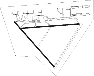
Runway info
Runway 07 / 25  | ||
| length | 1710m (5610ft) | |
| bearing | 90° / 270° | |
| width | 30m (100ft) | |
| surface | asphalt | |
| displ threshold | 0m (0ft) / 183m (600ft) | |
| Runway 13 / 31 | ||
| length | 1710m (5610ft) | |
| bearing | 131° / 311° | |
| width | 30m (100ft) | |
| surface | asphalt | |
| displ threshold | 200m (656ft) / 0m (0ft) | |
Nearby beacons
| code | identifier | dist | bearing | frequency |
|---|---|---|---|---|
| YVR | VANCOUVER VOR/DME | 5.1 | 269° | 115.90 |
| VR | VANCOUVER NDB | 5.8 | 337° | 266 |
| WC | WHITE ROCK NDB | 11.4 | 106° | 332 |
| YPK | PITT MEADOWS VOR | 14.4 | 66° | 112.40 |
| AP | ACTIVE PASS NDB | 16.3 | 233° | 378 |
| HUH | WHATCOM VORTAC | 19 | 107° | 113 |
| XX | ABBOTSFORD NDB | 21.2 | 97° | 344 |
| YYJ | VICTORIA VOR/DME | 28 | 233° | 113.70 |
| YJ | VICTORIA NDB | 30.1 | 221° | 200 |
| MB | MILL BAY (VICTORIA) NDB | 31.9 | 232° | 293 |
| YCD | NANAIMO NDB | 33.6 | 273° | 251 |
| FHR | FRIDAY HARBOR NDB | 34 | 181° | 284 |
| BVS | SKAGIT/BAY VIEW (BURLINGTON) NDB | 43.6 | 136° | 240 |
| NUW | WHIDBEY ISLAND (OAK HARBO TACAN | 45.7 | 154° | 113.80 |
| CVV | PENN COVE VOR/DME | 51.4 | 161° | 117.20 |
| NOW | EDIZ HOOK (PORT ANGELES) NDB | 58.4 | 202° | 338 |
| CL | ELWHA (PORT ANGELES) NDB | 61.5 | 215° | 515 |
Departure and arrival routes
| Transition altitude | 18000ft |
| Transition level | 18000ft |
| STAR starting points | distance | inbound heading | |
|---|---|---|---|
| ALL | |||
| MADEE4 | 50.4 | 320° | |
Instrument approach procedures
| runway | airway (heading) | route (dist, bearing) |
|---|---|---|
| RW07 | LEVIV (74°) | LEVIV KESBA (5mi, 0°) 1700ft |
| RNAV | KESBA 1700ft DUTOP (6mi, 90°) 1700ft XORDU (4mi, 90°) 520ft CZBB (2mi, 88°) 45ft HUH (19mi, 107°) 2000ft HUH (turn) | |
| RW31 | ESVEM (347°) | ESVEM GUDOD (5mi, 64°) 2000ft |
| RW31 | GUDOD (312°) | GUDOD 2000ft |
| RW31 | PENIN (312°) | PENIN GUDOD (4mi, 312°) 2000ft |
| RW31 | WC (286°) | WC GUDOD (6mi, 247°) 2000ft |
| RNAV | GUDOD 2000ft ETMUL (5mi, 311°) 1400ft CZBB (5mi, 312°) 55ft ESVEM (11mi, 167°) 2000ft ESVEM (turn) |
Disclaimer
The information on this website is not for real aviation. Use this data with the X-Plane flight simulator only! Data taken with kind consent from X-Plane 12 source code and data files. Content is subject to change without notice.