Fort Mcpherson
Airport details
| Country | Canada |
| State | Northwest Territories |
| Region | CY |
| Airspace | Edmonton Ctr |
| Municipality | Gwich'in Settlement Area |
| Elevation | 116ft (35m) |
| Timezone | GMT -7 |
| Coordinates | 67.40691, -134.85976 |
| Magnetic var | |
| Type | land |
| Available since | X-Plane v10.40 |
| ICAO code | CZFM |
| IATA code | ZFM |
| FAA code | n/a |
Communication
| Fort McPherson McPherson Radio | 122.100 |
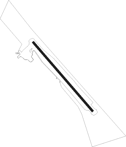
Runway info
| Runway 12 / 30 | ||
| length | 1199m (3934ft) | |
| bearing | 118° / 298° | |
| width | 30m (100ft) | |
| surface | gravel | |
Instrument approach procedures
| runway | airway (heading) | route (dist, bearing) |
|---|---|---|
| RW12 | EMLIV (101°) | EMLIV MUXOX (5mi, 74°) 2300ft |
| RW12 | KEDIK (152°) | KEDIK MUXOX (5mi, 254°) 2300ft |
| RNAV | MUXOX 2300ft OMTOG (6mi, 117°) 1500ft CZFM (5mi, 117°) 161ft VOBAN (5mi, 117°) 2600ft VOBAN (turn) | |
| RW30 | AVSOP (282°) | AVSOP DUSGA (5mi, 254°) 1600ft |
| RW30 | BIPNI (333°) | BIPNI DUSGA (5mi, 74°) 1600ft |
| RNAV | DUSGA 1600ft ESREN (6mi, 297°) 1500ft CZFM (5mi, 297°) 160ft OBSIB (5mi, 297°) 2700ft OBSIB (turn) |
Disclaimer
The information on this website is not for real aviation. Use this data with the X-Plane flight simulator only! Data taken with kind consent from X-Plane 12 source code and data files. Content is subject to change without notice.