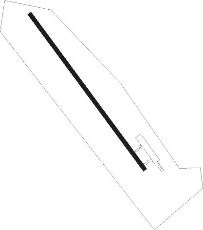
Masset
Airport details
| Country | Canada |
| State | British Columbia |
| Region | CY |
| Airspace | Vancouver Ctr |
| Municipality | Masset |
| Elevation | 23ft (7m) |
| Timezone | GMT -8 |
| Coordinates | 54.02711, -132.12508 |
| Magnetic var | |
| Type | land |
| Available since | X-Plane v10.40 |
| ICAO code | CZMT |
| IATA code | ZMT |
| FAA code | n/a |
Communication
| Masset CTAF/UNICOM | 122.700 |
Nearby beacons
| code | identifier | dist | bearing | frequency |
|---|---|---|---|---|
| ZZP | DEAD TREE (SANDSPIT) NDB | 41.1 | 165° | 248 |
| YZP | SANDSPIT VOR/DME | 47.8 | 158° | 114.10 |
Instrument approach procedures
| runway | airway (heading) | route (dist, bearing) |
|---|---|---|
| RW13-Y | ANTIV (168°) | ANTIV IKLOM (5mi, 250°) 1400ft |
| RW13-Y | RODGA (111°) | RODGA IKLOM (5mi, 70°) 1400ft |
| RNAV | IKLOM 1400ft NOTEM (6mi, 133°) 1400ft CZMT (5mi, 133°) 66ft URLUX (5mi, 133°) 1800ft URLUX (turn) | |
| RW13-Z | BIBOL (133°) | BIBOL ITNEV (5mi, 133°) 1600ft |
| RW13-Z | DAXEX (180°) | DAXEX ITNEV (7mi, 250°) 1600ft |
| RW13-Z | ITGIP (106°) | ITGIP ITNEV (7mi, 70°) 1600ft |
| RNAV | ITNEV 1600ft MIDPU (6mi, 133°) 1400ft MELTU (4mi, 133°) 226ft VERPU (5mi, 133°) 3500ft VERPU (turn) | |
| RW31 | MAVUT (289°) | MAVUT GABAS (5mi, 248°) 1700ft |
| RW31 | PIDLI (344°) | PIDLI GABAS (5mi, 68°) 1700ft |
| RNAV | GABAS 1700ft ADSID (6mi, 310°) 1400ft CZMT (5mi, 310°) 68ft URMAM (5mi, 310°) 1800ft URMAM (turn) | |
| RWNVA | BEMEM (313°) | BEMEM IGRUB (5mi, 313°) 1700ft |
| RWNVA | DATET (344°) | DATET IGRUB (5mi, 53°) 1700ft |
| RWNVA | TALKI (293°) | TALKI IGRUB (5mi, 263°) 1700ft |
| RNAV | IGRUB 1700ft IKLIP (6mi, 313°) 1200ft KEBMU (4mi, 313°) 860ft CZMT (turn) 760ft LIDAD (5mi, 313°) 3500ft LIDAD (turn) |
Disclaimer
The information on this website is not for real aviation. Use this data with the X-Plane flight simulator only! Data taken with kind consent from X-Plane 12 source code and data files. Content is subject to change without notice.
