Churchill Falls
Airport details
| Country | Canada |
| State | Newfoundland and Labrador |
| Region | CY |
| Airspace | Gander Oceanic Ctr |
| Municipality | Labrador |
| Elevation | 1439ft (439m) |
| Timezone | GMT -4 |
| Coordinates | 53.56263, -64.10593 |
| Magnetic var | |
| Type | land |
| Available since | X-Plane v10.40 |
| ICAO code | CZUM |
| IATA code | ZUM |
| FAA code | n/a |
Communication
| Churchill Falls AWOS | 118.950 |
| Churchill Falls CTAF | 123.500 |
Runway info
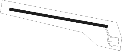
| Runway 13 / 31 | ||
| length | 1677m (5502ft) | |
| bearing | 99° / 279° | |
| width | 45m (148ft) | |
| surface | asphalt | |
Nearby beacons
| code | identifier | dist | bearing | frequency |
|---|---|---|---|---|
| UM | CHURCHILL FALLS NDB | 4.9 | 282° | 233 |
Instrument approach procedures
| runway | airway (heading) | route (dist, bearing) |
|---|---|---|
| RW13 | EPSUD (107°) | EPSUD ATHER (5mi, 179°) 3100ft |
| RW13 | TEVOM (74°) | TEVOM ATHER (5mi, 359°) 3100ft |
| RNAV | ATHER 3100ft XIKAN (5mi, 90°) 3000ft IKMOB (2mi, 90°) 2290ft VIXOB (2mi, 90°) 1636ft UDBOR (5mi, 90°) 3300ft UDBOR (turn) | |
| RW31 | AVILI (286°) | AVILI VITEP (5mi, 359°) 3300ft |
| RW31 | LODRI (254°) | LODRI VITEP (5mi, 179°) 3300ft |
| RNAV | VITEP 3300ft XUBUG (5mi, 270°) 3000ft EMKAN (3mi, 270°) 2120ft CZUM (2mi, 271°) 1474ft TIDAT (5mi, 269°) 3300ft TIDAT (turn) |
Disclaimer
The information on this website is not for real aviation. Use this data with the X-Plane flight simulator only! Data taken with kind consent from X-Plane 12 source code and data files. Content is subject to change without notice.