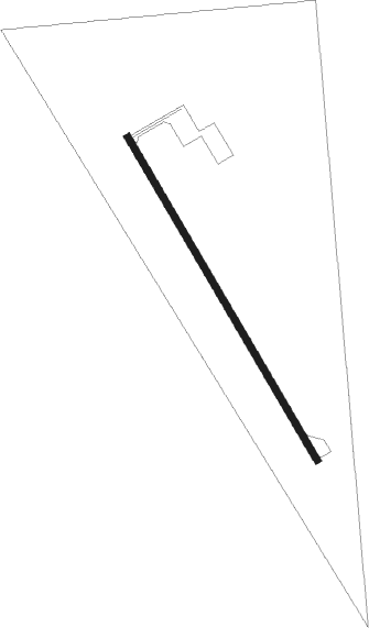
Ada/twin Valley - Norman County Ada/twin Valley
Airport details
| Country | United States of America |
| State | Minnesota |
| Region | K3 |
| Airspace | Minneapolis Ctr |
| Municipality | Norman County |
| Elevation | 954ft (291m) |
| Timezone | GMT -6 |
| Coordinates | 47.26047, -96.40026 |
| Magnetic var | |
| Type | land |
| Available since | X-Plane v11.50 |
| ICAO code | D00 |
| IATA code | n/a |
| FAA code | n/a |
Communication
| Norman County Ada/Twin Valley CTAF | 122.900 |
| Norman County Ada/Twin Valley FARGO Approach/Departure | 120.400 |
Nearby Points of Interest:
Congregational Church of Ada
-Ada Village Hall
-Mahnomen City Hall
-Mahnomen County Courthouse
-Zion Lutheran Church
-John Olness House
-Fargo City Detention Hospital
-James Holes House
-Fargo Oak Grove Residential Historic District
-North Dakota State University District
Runway info
| Runway 15 / 33 | ||
| length | 946m (3104ft) | |
| bearing | 144° / 324° | |
| width | 18m (60ft) | |
| surface | asphalt | |
Nearby beacons
| code | identifier | dist | bearing | frequency |
|---|---|---|---|---|
| AA | KENIE (FARGO) NDB | 22.7 | 239° | 365 |
| DTL | DETROIT LAKES VOR/DME | 33.5 | 130° | 111.20 |
| FAR | FARGO VOR/DME | 35.6 | 222° | 116.20 |
| GF | HISER NDB | 47.3 | 307° | 345 |
| TVF | THIEF RIVER FALLS VOR/DME | 49.3 | 15° | 114.45 |
| GFK | GRAND FORKS VOR/DME | 52.4 | 311° | 114.30 |
| FFM | FERGUS FALLS VOR/DME | 59.1 | 166° | 110.40 |
Instrument approach procedures
| runway | airway (heading) | route (dist, bearing) |
|---|---|---|
| RW33 | IRILE (14°) | IRILE ODOHU (9mi, 70°) 3000ft |
| RW33 | ODOHU (325°) | ODOHU 3000ft |
| RW33 | STRAW (278°) | STRAW NINDE (26mi, 269°) 3400ft ODOHU (5mi, 252°) 3000ft |
| RNAV | ODOHU 3000ft JOWZI (6mi, 325°) 2700ft WELEB (3mi, 325°) 1600ft D00 (2mi, 325°) 999ft (5666mi, 116°) 1354ft JODSO (5668mi, 296°) 3300ft JODSO (turn) 3300ft |
Disclaimer
The information on this website is not for real aviation. Use this data with the X-Plane flight simulator only! Data taken with kind consent from X-Plane 12 source code and data files. Content is subject to change without notice.
