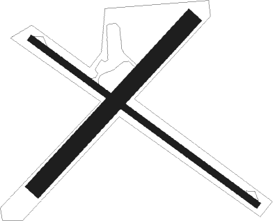
Warren - Warren Muni
Airport details
| Country | United States of America |
| State | Minnesota |
| Region | K3 |
| Airspace | Minneapolis Ctr |
| Municipality | Marshall County |
| Elevation | 886ft (270m) |
| Timezone | GMT -6 |
| Coordinates | 48.19117, -96.71130 |
| Magnetic var | |
| Type | land |
| Available since | X-Plane v10.40 |
| ICAO code | D37 |
| IATA code | n/a |
| FAA code | n/a |
Communication
| Warren Muni CTAF/UNICOM | 122.800 |
| Warren Muni GRAND FORKS Approach/Departure | 118.100 |
Nearby Points of Interest:
Old Mill State Park WPA/Rustic Style Historic Resources
-Hamm Brewing Company Beer Depot
-Grand Forks Riverside Neighborhood Historic District
-St. Michael's Hospital and Nurses' Residence
-Grand Forks Mercantile Building 1898
-Grand Forks Mercantile Co.
-Northern Pacific Depot and Freight House
-St. John's Block Commercial Exchange
-Building at 201 S. 3rd St.
-Speed Printing
-Iddings Block
-New Hampshire Apartments
-Roller Office Supply
-Metropolitan Opera House
-312 Kittson Avenue
-Stratford Building
-North Dakota Mill and Elevator
-Telephone Co. Building
-Ronald N. Davies Federal Building and U.S. Courthouse
-Lyons Garage
-First National Bank
-Odd Fellows Block
-Dakota Block
-Hook and Ladder No. 1 and Hose Co. No. 2
-Grand Forks City Hall
Nearby beacons
| code | identifier | dist | bearing | frequency |
|---|---|---|---|---|
| TVF | THIEF RIVER FALLS VOR/DME | 22.2 | 103° | 114.45 |
| GFK | GRAND FORKS VOR/DME | 23.7 | 244° | 114.30 |
| GF | HISER NDB | 28 | 234° | 345 |
| RDR | RED RIVER (GRAND FORKS) TACAN | 31.2 | 251° | 116.40 |
| HML | HUMBOLDT TACAN | 43.8 | 329° | 112.40 |
Instrument approach procedures
| runway | airway (heading) | route (dist, bearing) |
|---|---|---|
| RW30 | QAVMY (300°) | QAVMY 2700ft |
| RW30 | UHEVU (327°) | UHEVU QAVMY (5mi, 52°) 2700ft |
| RW30 | ZOCXE (280°) | ZOCXE QAVMY (5mi, 232°) 2700ft |
| RNAV | QAVMY 2700ft EYOJE (5mi, 300°) 2500ft D37 (5mi, 300°) 925ft (5674mi, 116°) 2000ft QAVMY (5666mi, 296°) 2700ft QAVMY (turn) |
Disclaimer
The information on this website is not for real aviation. Use this data with the X-Plane flight simulator only! Data taken with kind consent from X-Plane 12 source code and data files. Content is subject to change without notice.

