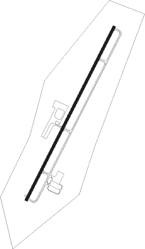
Monroe - Monroe-walton Co
Airport details
| Country | United States of America |
| State | Georgia |
| Region | K7 |
| Airspace | Atlanta Ctr |
| Municipality | Monroe |
| Elevation | 875ft (267m) |
| Timezone | GMT -5 |
| Coordinates | 33.78253, -83.69280 |
| Magnetic var | |
| Type | land |
| Available since | X-Plane v10.40 |
| ICAO code | D73 |
| IATA code | n/a |
| FAA code | D73 |
Communication
| Monroe-Walton CO CTAF | 122.900 |
| Monroe-Walton CO ATLANTA Approach/Departure | 126.975 |
Nearby Points of Interest:
William Harris Homestead
-Kilgore Mill Covered Bridge and Mill Site
-Hard Labor Creek State Park
-Brick Store
-Barrow County Courthouse
-Orna Villa
-Oxford Historic District
-Newton County Courthouse
-Carter-Newton House
-Starrsville Historic District
-Elder's Mill Covered Bridge and Elder Mill
-Almand-O'Kelley-Walker House
-Old Seminary Building
-UGA Carnegie Library
-Gwinnett County Courthouse
-Lucy Cobb Institute
-Cobbham Historic District
-Henry W. Grady House
-Camak House
-Joseph Henry Lumpkin House
-Ware-Lyndon house
-Gospel Pilgrim Cemetery
-Aaron and Margaret Parker Jr. House
-Bowman-Pirkle House
-John Quincy Allen House
Nearby beacons
| code | identifier | dist | bearing | frequency |
|---|---|---|---|---|
| VOF | ALCOVY (COVINGTON) NDB | 10.2 | 210° | 370 |
| BMW | BARROW COUNTY (WINDER) NDB | 10.5 | 34° | 404 |
| TX | GWNET (LAWRENCEVILLE) NDB | 16.5 | 324° | 419 |
| AHN | ATHENS VOR/DME | 20.8 | 66° | 109.60 |
| FKV | FLOWERY BRANCH (GAINESVILLE) NDB | 27.4 | 333° | 365 |
| PDK | PEACHTREE (ATLANTA) VOR/DME | 30.7 | 279° | 116.60 |
| VV | JUNNE (GREENSBORO) NDB | 34.5 | 101° | 353 |
| ATL | ATLANTA VORTAC | 38.2 | 258° | 116.90 |
| DOB | DOBBINS (MARIETTA) TACAN | 41.3 | 279° | 113 |
| AT | CATTA (ATLANTA) NDB | 43.2 | 261° | 375 |
| UMB | CULVR (MILLEDGEVILLE) NDB | 46.3 | 140° | 380 |
| DJD | CHERO NDB | 48.5 | 301° | 415 |
| FFC | PECAT (ATLANTA) NDB | 49.1 | 239° | 316 |
| OP | YATES (THOMASTON) NDB | 57.4 | 210° | 339 |
| ODF | FOOTHILLS (TOCCOA) VOR/DME | 58.2 | 23° | 113.40 |
| ELW | ELECTRIC CITY (ANDERSON) VORTAC | 59.1 | 55° | 108.60 |
Departure and arrival routes
| Transition altitude | 18000ft |
| Transition level | 18000ft |
| STAR starting points | distance | inbound heading | |
|---|---|---|---|
| ALL | |||
| SWTEE2 | 73.4 | 97° | |
| BUKHD3 | 82.6 | 116° | |
| DEHAN3 | 44.3 | 157° | |
| WRGNZ3 | 24.2 | 357° | |
Instrument approach procedures
| runway | airway (heading) | route (dist, bearing) |
|---|---|---|
| RW03 | MADDI (292°) | MADDI JULGA (20mi, 262°) 2600ft JULGA (turn) 2600ft |
| RW03 | SINCA (353°) | SINCA JULGA (34mi, 339°) 2600ft |
| RNAV | JULGA 2600ft HADEL (6mi, 36°) 2600ft CELVO (3mi, 36°) 1740ft D73 (3mi, 36°) 915ft (5091mi, 112°) 1300ft JULGA (5096mi, 292°) 2600ft JULGA (turn) |
Holding patterns
| STAR name | hold at | type | turn | heading* | altitude | leg | speed limit |
|---|---|---|---|---|---|---|---|
| BUKHD3 | HLNDS | VHF | right | 327 (147)° | DME 10.0mi | ICAO rules | |
| DEHAN3 | AWSON | VHF | left | 29 (209)° | DME 10.0mi | ICAO rules | |
| DEHAN3 | TRALZ | VHF | right | 32 (212)° | DME 10.0mi | ICAO rules | |
| SWTEE2 | BIZKT | VHF | left | 292 (112)° | DME 10.0mi | ICAO rules | |
| *) magnetic outbound (inbound) holding course | |||||||
Disclaimer
The information on this website is not for real aviation. Use this data with the X-Plane flight simulator only! Data taken with kind consent from X-Plane 12 source code and data files. Content is subject to change without notice.