Romeo - Romeo State
Airport details
| Country | United States of America |
| State | Michigan |
| Region | K5 |
| Airspace | Cleveland Ctr |
| Municipality | Macomb County |
| Elevation | 736ft (224m) |
| Timezone | GMT -5 |
| Coordinates | 42.79633, -82.97426 |
| Magnetic var | |
| Type | land |
| Available since | X-Plane v10.40 |
| ICAO code | D98 |
| IATA code | n/a |
| FAA code | D98 |
Communication
| Romeo State CTAF/UNICOM | 122.800 |
| Romeo State SELFRIDGE Approach/Departure | 119.600 |
Nearby Points of Interest:
Romeo Historic District
-Wolcott Mill
-Loren Andrus Octagon House
-Axford-Coffin Farm
-Eli and Sidney Teeter Albertson House
-Old Town
-Currier House
-West Saint Clair Street Historic District
-Packard Proving Grounds
-Paint Creek Trail
-Clinton–Kalamazoo Canal
-First Congregational Church
-Rochester Grain Elevator
-Western Knitting Mills
-Rollin Sprague Building
-Masters Road–Belle River Bridge
-Lake Orion Historic District
-John W. Day House
-Indian Lake Road Stone Arch Bridge
-Grand Trunk Western Railroad, Mount Clemens Station
-William Upton House
-Meadow Brook Hall
-Oxford Downtown Historic District
-Holcombe Site
-James F. Fairweather–Jacob C. Lamb House
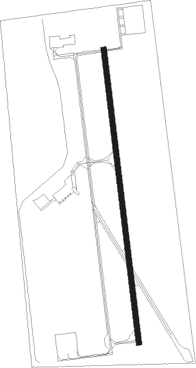
Runway info
| Runway 18 / 36 | ||
| length | 1222m (4009ft) | |
| bearing | 177° / 357° | |
| width | 23m (75ft) | |
| surface | asphalt | |
| displ threshold | 144m (472ft) / 0m (0ft) | |
Nearby beacons
| code | identifier | dist | bearing | frequency |
|---|---|---|---|---|
| MTC | SELFRIDGE (MOUNT CLEMENS) TACAN | 12.6 | 142° | 133.70 |
| PH | PHURN (PORT HURON) NDB | 16.8 | 83° | 332 |
| PSI | DME | 25.2 | 260° | 111 |
| QG | WINDSOR NDB | 29.4 | 168° | 353 |
| ECK | PECK TACAN | 29.8 | 29° | 114 |
| FNT | FLINT VORTAC | 35.5 | 282° | 116.90 |
| SVM | SALEM VORTAC | 35.9 | 238° | 114.30 |
| DM | SPENC (DETROIT) NDB | 36 | 202° | 223 |
| DXO | DETROIT VOR/DME | 39 | 214° | 113.40 |
| RYS | GROSSE ILE (DETROIT) NDB | 42.4 | 194° | 419 |
| DT | REVUP (DETROIT) NDB | 45.3 | 214° | 388 |
| CRL | CARLETON VOR/DME | 49.7 | 213° | 115.70 |
| TCU | TECUMSEH NDB | 61 | 230° | 239 |
Instrument approach procedures
| runway | airway (heading) | route (dist, bearing) |
|---|---|---|
| RW18 | UTEBE (177°) | UTEBE 6000ft UTEBE (turn) 2900ft |
| RNAV | UTEBE 2900ft YALUG (7mi, 177°) 2400ft VOCUV (2mi, 177°) 1600ft D98 (3mi, 177°) 788ft (5096mi, 117°) 1139ft WELAS (5094mi, 297°) 2900ft WELAS (turn) | |
| RW36 | WELAS (357°) | WELAS 6000ft WELAS (turn) 2900ft |
| RNAV | WELAS 2900ft ZADBO (6mi, 357°) 2400ft UFSIW (3mi, 357°) 1400ft D98 (2mi, 357°) 778ft (5096mi, 117°) 1139ft UTEBE (5097mi, 297°) 2900ft UTEBE (turn) |
Disclaimer
The information on this website is not for real aviation. Use this data with the X-Plane flight simulator only! Data taken with kind consent from X-Plane 12 source code and data files. Content is subject to change without notice.