Abadla - Hamaguir
Airport details
| Country | Algeria |
| State | Bashar |
| Region | |
| Airspace | Algiers Ctr |
| Municipality | Mechraa Houari Boumediene |
| Elevation | 2454ft (748m) |
| Timezone | GMT +1 |
| Coordinates | 30.87666, -3.06169 |
| Magnetic var | |
| Type | land |
| Available since | X-Plane v10.40 |
| ICAO code | DA11 |
| IATA code | n/a |
| FAA code | n/a |
Communication
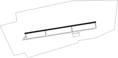
Runway info
| Runway 09 / 27 | ||
| length | 3193m (10476ft) | |
| bearing | 86° / 266° | |
| width | 45m (148ft) | |
| surface | concrete | |
| blast zone | 201m (659ft) / 250m (820ft) | |
Nearby beacons
| code | identifier | dist | bearing | frequency |
|---|---|---|---|---|
| BCR | BECHAR NDB | 63.4 | 46° | 407 |
| BCR | BECHAR VOR/DME | 63.5 | 45° | 113.90 |
| BBS | BENI ABBES NDB | 66.6 | 136° | 320 |
| BBS | BENI ABBES VOR/DME | 66.8 | 136° | 115.30 |
Disclaimer
The information on this website is not for real aviation. Use this data with the X-Plane flight simulator only! Data taken with kind consent from X-Plane 12 source code and data files. Content is subject to change without notice.