Man
Airport details
| Country | Ivory Coast |
| State | Montagnes |
| Region | DI |
| Airspace | Dakar Ctr |
| Municipality | Tonkpi |
| Elevation | 1088ft (332m) |
| Timezone | GMT +0 |
| Coordinates | 7.27151, -7.58963 |
| Magnetic var | |
| Type | land |
| Available since | X-Plane v10.40 |
| ICAO code | DIMN |
| IATA code | MJC |
| FAA code | n/a |
Communication
| Man AFIS | 118.400 |
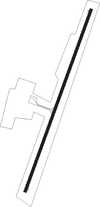
Runway info
| Runway 03 / 21 | ||
| length | 2058m (6752ft) | |
| bearing | 25° / 205° | |
| width | 30m (98ft) | |
| surface | asphalt | |
Nearby beacons
| code | identifier | dist | bearing | frequency |
|---|---|---|---|---|
| MAN | MAN VOR/DME | 1.1 | 31° | 116.20 |
Instrument approach procedures
| runway | airway (heading) | route (dist, bearing) |
|---|---|---|
| RW03 | KOPOS (2°) | KOPOS 4100ft BOTSI (5mi, 295°) 4100ft |
| RW03 | MOLAN (46°) | MOLAN 4100ft BOTSI (5mi, 115°) 4100ft |
| RNAV | BOTSI 4100ft MN501 (5mi, 25°) 3200ft DIMN (7mi, 24°) 1115ft MN502 (5mi, 26°) KOPOS (18mi, 188°) 4100ft | |
| RW21 | DEVRA (248°) | DEVRA 4100ft MN503 (6mi, 320°) 3300ft |
| RW21 | PORAX (233°) | PORAX 6100ft MN503 (10mi, 250°) 3300ft |
| RNAV | MN503 3300ft MN504 (5mi, 230°) 2900ft DIMN (6mi, 206°) 1132ft MN506 (4mi, 203°) DEVRA (15mi, 56°) 4100ft |
Disclaimer
The information on this website is not for real aviation. Use this data with the X-Plane flight simulator only! Data taken with kind consent from X-Plane 12 source code and data files. Content is subject to change without notice.