San Pedro
Airport details
| Country | Ivory Coast |
| State | Bas-Sassandra |
| Region | DI |
| Airspace | Dakar Ctr |
| Municipality | San-Pédro |
| Elevation | 24ft (7m) |
| Timezone | GMT +0 |
| Coordinates | 4.74762, -6.66023 |
| Magnetic var | |
| Type | land |
| Available since | X-Plane v10.40 |
| ICAO code | DISP |
| IATA code | SPY |
| FAA code | n/a |
Communication
| San Pedro Tower | 118.600 |
Runway info
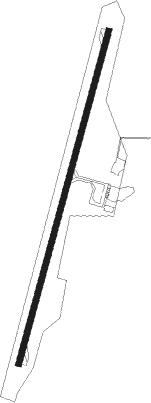
| Runway 03 / 21 | ||
| length | 1912m (6273ft) | |
| bearing | 20° / 200° | |
| width | 30m (98ft) | |
| surface | asphalt | |
| blast zone | 105m (344ft) / 105m (344ft) | |
Nearby beacons
| code | identifier | dist | bearing | frequency |
|---|---|---|---|---|
| SPO | SAN PEDRO VOR/DME | 0.5 | 31° | 114.90 |
Instrument approach procedures
| runway | airway (heading) | route (dist, bearing) |
|---|---|---|
| RW03 | DOPER (356°) | DOPER 1700ft TATOR (5mi, 290°) 1700ft |
| RW03 | POSOR (43°) | POSOR 1700ft TATOR (5mi, 110°) 1700ft |
| RNAV | TATOR 1700ft SP501 (6mi, 20°) 1700ft DISP (6mi, 20°) 64ft SP502 (4mi, 20°) DOPER (17mi, 182°) 1700ft | |
| RW21 | KOKUT (176°) | KOKUT 2400ft GUROS (5mi, 110°) 1800ft |
| RW21 | MEMER (223°) | MEMER 1800ft GUROS (5mi, 290°) 1800ft |
| RNAV | GUROS 1800ft SP503 (6mi, 200°) 1800ft DISP (6mi, 200°) 76ft SP504 (5mi, 200°) MEMER (17mi, 37°) 1800ft |
Disclaimer
The information on this website is not for real aviation. Use this data with the X-Plane flight simulator only! Data taken with kind consent from X-Plane 12 source code and data files. Content is subject to change without notice.