Eket
Airport details
| Country | Nigeria |
| State | Akwa Ibom State |
| Region | DN |
| Airspace | Kano Ctr |
| Municipality | Eket |
| Elevation | 0ft (0m) |
| Timezone | GMT +1 |
| Coordinates | 4.64901, 7.94981 |
| Magnetic var | |
| Type | land |
| Available since | X-Plane v10.40 |
| ICAO code | DN55 |
| IATA code | n/a |
| FAA code | n/a |
Communication
| Eket Eket Tower | 118.300 |
Runway info
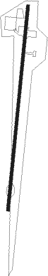
| Runway 01 / 19 | ||
| length | 1457m (4780ft) | |
| bearing | 10° / 190° | |
| width | 21m (69ft) | |
| surface | asphalt | |
| displ threshold | 0m (0ft) / 145m (476ft) | |
Nearby beacons
| code | identifier | dist | bearing | frequency |
|---|---|---|---|---|
| AI | UYO NDB | 14.3 | 33° | 397 |
| AKW | UYO VOR/DME | 17.4 | 32° | 113.80 |
| CAL | CALABAR VOR/DME | 27.5 | 54° | 114.10 |
| CR | CALABAR NDB | 30.5 | 51° | 317 |
| FB | FINIMA NDB | 48.5 | 252° | 332 |
| OW | OWERRI NDB | 63.4 | 316° | 320 |
| POT | PORT HARCOURT VOR/DME | 63.5 | 291° | 113.50 |
| OWR | OWERRI VOR/DME | 65.6 | 317° | 114.90 |
| MBO | MALABO VOR/DME | 70.1 | 139° | 114.50 |
Disclaimer
The information on this website is not for real aviation. Use this data with the X-Plane flight simulator only! Data taken with kind consent from X-Plane 12 source code and data files. Content is subject to change without notice.