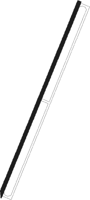
Calabar
Airport details
| Country | Nigeria |
| State | Cross River State |
| Region | DN |
| Airspace | Kano Ctr |
| Municipality | Calabar |
| Elevation | 208ft (63m) |
| Timezone | GMT +1 |
| Coordinates | 4.97605, 8.34730 |
| Magnetic var | |
| Type | land |
| Available since | X-Plane v10.40 |
| ICAO code | DNCA |
| IATA code | CBQ |
| FAA code | n/a |
Communication
| CALABAR Tower | 124.500 |
Approach frequencies
| ILS-cat-I | RW21 | 109.1 | 18.00mi |
| 3° GS | RW21 | 109.1 | 18.00mi |
Nearby beacons
| code | identifier | dist | bearing | frequency |
|---|---|---|---|---|
| CR | CALABAR NDB | 0.5 | 175° | 317 |
| CAL | CALABAR VOR/DME | 3.6 | 207° | 114.10 |
| AKW | UYO VOR/DME | 15.2 | 252° | 113.80 |
| AI | UYO NDB | 17.6 | 244° | 397 |
| MF | MAMFE VOR | 72 | 53° | 115.10 |
Instrument approach procedures
| runway | airway (heading) | route (dist, bearing) |
|---|---|---|
| RW03 | IPENU (51°) | IPENU ARLAP (5mi, 117°) 2500ft |
| RW03 | ODMUD (3°) | ODMUD ARLAP (5mi, 297°) 2500ft |
| RW03 | VITNO (27°) | VITNO ARLAP (5mi, 27°) 2500ft |
| RNAV | ARLAP 2500ft CA900 (5mi, 27°) 2000ft DNCA (6mi, 27°) 248ft (583mi, 239°) 610ft ODMUD (576mi, 60°) ARLAP (5mi, 297°) 2500ft ARLAP (turn) 2500ft | |
| RW21 | BOSBU (207°) | BOSBU BUKDU (5mi, 207°) 2500ft |
| RW21 | ILKIB (231°) | ILKIB BUKDU (5mi, 297°) 2500ft |
| RW21 | POTUT (183°) | POTUT BUKDU (5mi, 117°) 2500ft |
| RNAV | BUKDU 2500ft CA400 (5mi, 207°) 2000ft DNCA (6mi, 207°) 259ft CA444 (2mi, 207°) ILKIB (14mi, 47°) BUKDU (5mi, 297°) 2500ft BUKDU (turn) 2500ft |
Disclaimer
The information on this website is not for real aviation. Use this data with the X-Plane flight simulator only! Data taken with kind consent from X-Plane 12 source code and data files. Content is subject to change without notice.
