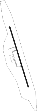
Owerri - Sam Mbakwe Intl Cargo
Airport details
| Country | Nigeria |
| State | Imo State |
| Region | DN |
| Airspace | Kano Ctr |
| Municipality | Ngor-Okpala |
| Elevation | 374ft (114m) |
| Timezone | GMT +1 |
| Coordinates | 5.42716, 7.20603 |
| Magnetic var | |
| Type | land |
| Available since | X-Plane v10.40 |
| ICAO code | DNIM |
| IATA code | QOW |
| FAA code | n/a |
Communication
| Sam Mbakwe Intl Cargo Tower | 118.400 |
Approach frequencies
| ILS-cat-I | RW17 | 110.9 | 18.00mi |
| 3° GS | RW17 | 110.9 | 18.00mi |
Nearby beacons
| code | identifier | dist | bearing | frequency |
|---|---|---|---|---|
| OW | OWERRI NDB | 1.2 | 167° | 320 |
| OWR | OWERRI VOR/DME | 1.2 | 347° | 114.90 |
| POT | PORT HARCOURT VOR/DME | 27.6 | 212° | 113.50 |
| SAB | ASABA VOR/DME | 55.5 | 326° | 112.60 |
| AKW | UYO VOR/DME | 62.5 | 121° | 113.80 |
| AI | UYO NDB | 62.8 | 123° | 397 |
Instrument approach procedures
| runway | airway (heading) | route (dist, bearing) |
|---|---|---|
| RW17 | GAGAB (167°) | GAGAB EMVUP (5mi, 167°) 2400ft |
| RW17 | OVSES (190°) | OVSES EMVUP (5mi, 257°) 2400ft |
| RW17 | XULOX (144°) | XULOX EMVUP (5mi, 77°) 2400ft |
| RNAV | EMVUP 2400ft IM400 (5mi, 167°) 2400ft DNIM (7mi, 167°) 422ft (541mi, 233°) 780ft OVSES (551mi, 52°) EMVUP (5mi, 257°) EMVUP (turn) 2400ft | |
| RW35 | GUNUN (324°) | GUNUN IM501 (5mi, 257°) 2400ft |
| RW35 | IKVEP (347°) | IKVEP IM501 (5mi, 347°) 2400ft |
| RW35 | KEGUR (10°) | KEGUR IM501 (5mi, 77°) 2400ft |
| RNAV | IM501 2400ft IM500 (5mi, 347°) 2400ft DNIM (7mi, 347°) 423ft (541mi, 233°) 780ft GUNUN (541mi, 54°) GUNUN (turn) 2400ft |
Disclaimer
The information on this website is not for real aviation. Use this data with the X-Plane flight simulator only! Data taken with kind consent from X-Plane 12 source code and data files. Content is subject to change without notice.
