Kano - Mallam Aminu Kano Intl
Airport details
| Country | Nigeria |
| State | Kano State |
| Region | DN |
| Airspace | Kano Ctr |
| Municipality | Kwachiri |
| Elevation | 1562ft (476m) |
| Timezone | GMT +1 |
| Coordinates | 12.04806, 8.52361 |
| Magnetic var | |
| Type | land |
| Available since | X-Plane v10.40 |
| ICAO code | DNKN |
| IATA code | KAN |
| FAA code | n/a |
Communication
| Mallam Aminu Kano Intl ATIS | 123.600 |
| Mallam Aminu Kano Intl KANO Ground Control | 121.700 |
| Mallam Aminu Kano Intl KANO Tower | 118.100 |
| Mallam Aminu Kano Intl KANO Approach | 124.100 |
Approach frequencies
| ILS-cat-II | RW24 | 111.1 | 18.00mi |
| ILS-cat-II | RW06 | 109.5 | 18.00mi |
| 3° GS | RW24 | 111.1 | 18.00mi |
| 3° GS | RW06 | 109.5 | 18.00mi |
Nearby Points of Interest:
Ancient Kano City Walls
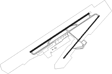
Runway info
Runway 06 / 24  | ||
| length | 3303m (10837ft) | |
| bearing | 62° / 242° | |
| width | 60m (197ft) | |
| surface | asphalt | |
| blast zone | 114m (374ft) / 114m (374ft) | |
| Runway 05 / 23 | ||
| length | 2608m (8556ft) | |
| bearing | 45° / 225° | |
| width | 45m (148ft) | |
| surface | asphalt | |
| displ threshold | 152m (499ft) / 0m (0ft) | |
| blast zone | 0m (0ft) / 60m (197ft) | |
Nearby beacons
| code | identifier | dist | bearing | frequency |
|---|---|---|---|---|
| AO | KANO NDB | 1.2 | 60° | 340 |
| KAN | KANO VOR/DME | 1.7 | 246° | 112.50 |
| DUT | DUTSE VOR/DME | 49 | 107° | 116.90 |
| ZA | ZARIA NDB | 72.9 | 222° | 336 |
Departure and arrival routes
| Transition altitude | 5000ft |
| Transition level | 6500ft |
| SID end points | distance | outbound heading | |
|---|---|---|---|
| RW06 | |||
| DETA1M | 53mi | 19° | |
| BOMV1M | 59mi | 217° | |
| RW24 | |||
| DETA1N | 53mi | 19° | |
| BOMV1N | 59mi | 217° | |
| STAR starting points | distance | inbound heading | |
|---|---|---|---|
| RW06 | |||
| KIBT1R | 72.9 | 20° | |
| DETA1R | 52.8 | 199° | |
| ODNO1R | 68.4 | 272° | |
| ISGA1R | 69.1 | 306° | |
| RW24 | |||
| KIBT1S | 72.9 | 20° | |
| DETA1S | 52.8 | 199° | |
| ODNO1S | 68.4 | 272° | |
| ISGA1S | 69.1 | 306° | |
Instrument approach procedures
| runway | airway (heading) | route (dist, bearing) |
|---|---|---|
| RW06 | OXIRI (62°) | OXIRI TISOK (5mi, 61°) 4000ft |
| RW06 | PISNU (27°) | PISNU KN402 (5mi, 241°) TISOK (5mi, 331°) 4000ft |
| RW06 | SISKO (290°) | SISKO PISNU (11mi, 241°) KN402 (5mi, 241°) TISOK (5mi, 331°) 4000ft |
| RNAV | TISOK 4000ft KN400 (5mi, 61°) 3400ft DNKN (7mi, 63°) 1610ft (884mi, 215°) 2500ft KN402 (871mi, 35°) 4000ft KN402 (turn) 4000ft | |
| RW24 | ARAKO (231°) | ARAKO TUMIX (5mi, 210°) 4000ft |
| RW24 | IRMON (280°) | IRMON NENGI (5mi, 62°) TUMIX (5mi, 331°) 4000ft |
| RW24 | NENGI (265°) | NENGI TUMIX (5mi, 331°) 4000ft |
| RNAV | TUMIX 4000ft KN600 (5mi, 242°) 3200ft DNKN (6mi, 240°) 1556ft (884mi, 215°) 2000ft ARAKO (899mi, 36°) 4000ft ARAKO (turn) 4000ft |
Holding patterns
| STAR name | hold at | type | turn | heading* | altitude | leg | speed limit |
|---|---|---|---|---|---|---|---|
| DETA1R | TISOK | VHF | right | 242 (62)° | > 4000ft | 1.0min timed | 200 |
| DETA1S | TUMIX | VHF | right | 62 (242)° | > 4000ft | 1.0min timed | 200 |
| ISGA1R | TISOK | VHF | right | 242 (62)° | > 4000ft | 1.0min timed | 200 |
| ISGA1S | TUMIX | VHF | right | 62 (242)° | > 4000ft | 1.0min timed | 200 |
| KIBT1R | TISOK | VHF | right | 242 (62)° | > 4000ft | 1.0min timed | 200 |
| KIBT1S | TUMIX | VHF | right | 62 (242)° | > 4000ft | 1.0min timed | 200 |
| ODNO1R | TISOK | VHF | right | 242 (62)° | > 4000ft | 1.0min timed | 200 |
| ODNO1S | TUMIX | VHF | right | 62 (242)° | > 4000ft | 1.0min timed | 200 |
| *) magnetic outbound (inbound) holding course | |||||||
Disclaimer
The information on this website is not for real aviation. Use this data with the X-Plane flight simulator only! Data taken with kind consent from X-Plane 12 source code and data files. Content is subject to change without notice.