Port Harcourt - Port Harcourt Intl
Airport details
| Country | Nigeria |
| State | Rivers State |
| Region | DN |
| Airspace | Kano Ctr |
| Municipality | Ikwerre |
| Elevation | 85ft (26m) |
| Timezone | GMT +1 |
| Coordinates | 5.02361, 6.95803 |
| Magnetic var | |
| Type | land |
| Available since | X-Plane v10.40 |
| ICAO code | DNPO |
| IATA code | PHC |
| FAA code | n/a |
Communication
| Port Harcourt INTL ATIS | 123.800 |
| Port Harcourt INTL Tower | 118.900 |
| Port Harcourt INTL Approach | 124.900 |
Approach frequencies
| ILS-cat-I | RW21 | 110.3 | 18.00mi |
| 3° GS | RW21 | 110.3 | 18.00mi |
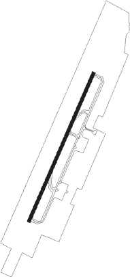
Runway info
| Runway 03 / 21 | ||
| length | 3014m (9888ft) | |
| bearing | 28° / 208° | |
| width | 60m (197ft) | |
| surface | asphalt | |
| blast zone | 122m (400ft) / 122m (400ft) | |
Nearby beacons
| code | identifier | dist | bearing | frequency |
|---|---|---|---|---|
| POT | PORT HARCOURT VOR/DME | 0.7 | 12° | 113.50 |
| OW | OWERRI NDB | 27.5 | 33° | 320 |
| OWR | OWERRI VOR/DME | 29.3 | 30° | 114.90 |
| FB | FINIMA NDB | 39.4 | 161° | 332 |
Departure and arrival routes
| Transition altitude | 3500ft |
| Transition level | 5000ft |
| SID end points | distance | outbound heading | |
|---|---|---|---|
| RW21 | |||
| ETVU1S | 51mi | 24° | |
| AKDI1S | 50mi | 312° | |
| STAR starting points | distance | inbound heading | |
|---|---|---|---|
| RW21 | |||
| ARAG1R | 50.4 | 112° | |
| BORM1R | 47.3 | 183° | |
| ODRE1R | 48.5 | 276° | |
Instrument approach procedures
| runway | airway (heading) | route (dist, bearing) |
|---|---|---|
| RW21 | GAMEP (179°) | GAMEP BINIM (5mi, 118°) 2000ft |
| RW21 | IPUKA (235°) | IPUKA BINIM (5mi, 298°) 2000ft |
| RW21 | PITVU (207°) | PITVU BINIM (6mi, 208°) 2000ft |
| RNAV | BINIM 2000ft PO400 (5mi, 208°) 1500ft DNPO (4mi, 205°) 140ft DNPO (turn) 600ft PO410 (7mi, 339°) GAMEP (5mi, 28°) 2000ft BINIM (5mi, 118°) BINIM (turn) 2000ft |
Holding patterns
| STAR name | hold at | type | turn | heading* | altitude | leg | speed limit |
|---|---|---|---|---|---|---|---|
| ARAG1R | BINIM | VHF | right | 30 (210)° | > 2400ft | 1.0min timed | 230 |
| BORM1R | BINIM | VHF | right | 30 (210)° | > 2400ft | 1.0min timed | 230 |
| ODRE1R | BINIM | VHF | right | 30 (210)° | > 2400ft | 1.0min timed | 230 |
| *) magnetic outbound (inbound) holding course | |||||||
Disclaimer
The information on this website is not for real aviation. Use this data with the X-Plane flight simulator only! Data taken with kind consent from X-Plane 12 source code and data files. Content is subject to change without notice.