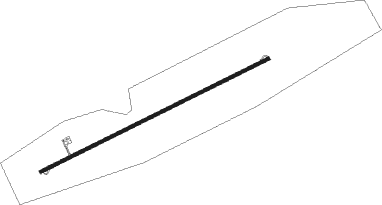
Agadez - Manu Dayak
Airport details
| Country | Niger |
| State | Agadez Region |
| Region | DR |
| Airspace | Niamey Ctr |
| Municipality | Agadez |
| Elevation | 1657ft (505m) |
| Timezone | GMT +1 |
| Coordinates | 16.96231, 7.99039 |
| Magnetic var | |
| Type | land |
| Available since | X-Plane v10.40 |
| ICAO code | DRZA |
| IATA code | AJY |
| FAA code | n/a |
Communication
| MANU DAYAK Agades Tower | 118.100 |
Nearby Points of Interest:
Historic Center of Agadez
Nearby beacons
| code | identifier | dist | bearing | frequency |
|---|---|---|---|---|
| AS | AGADEZ NDB | 0.9 | 249° | 340 |
| AS | AGADEZ VOR | 2 | 69° | 113.50 |
Instrument approach procedures
| runway | airway (heading) | route (dist, bearing) |
|---|---|---|
| RW07L | AMGOR (69°) | AMGOR 3600ft |
| RW07L | EDKUS (92°) | EDKUS 3600ft AMGOR (5mi, 157°) 3600ft |
| RW07L | VOTIS (45°) | VOTIS 3600ft AMGOR (5mi, 337°) 3600ft |
| RNAV | AMGOR 3600ft ZA501 (5mi, 69°) 3600ft DRZA (6mi, 69°) 1704ft ZA502 (5mi, 69°) VOTIS (17mi, 232°) 3600ft | |
| RW07R | DENET (39°) | DENET 3600ft IPOPO (5mi, 337°) 3600ft |
| RW07R | IPOPO (64°) | IPOPO 3600ft |
| RW07R | NEMLA (90°) | NEMLA 3600ft IPOPO (5mi, 157°) 3600ft |
| RNAV | IPOPO 3600ft ZA506 (5mi, 69°) 3600ft DRZA (5mi, 59°) 1690ft ZA507 (6mi, 78°) DENET (17mi, 232°) 3600ft | |
| RW25L | ERENI (253°) | ERENI 3900ft |
| RW25L | NAPIL (232°) | NAPIL 3900ft ERENI (5mi, 157°) 3900ft |
| RW25L | UPAKI (273°) | UPAKI 3900ft ERENI (5mi, 337°) 3900ft |
| RNAV | ERENI 3900ft ZA508 (5mi, 249°) 3600ft DRZA (8mi, 256°) 1713ft ZA509 (3mi, 232°) UPAKI (17mi, 86°) 3900ft | |
| RW25R | ERMAS (249°) | ERMAS 3900ft |
| RW25R | GASIM (227°) | GASIM 3900ft ERMAS (5mi, 157°) 3900ft |
| RW25R | RAMUP (270°) | RAMUP 3900ft ERMAS (5mi, 337°) 3900ft |
| RNAV | ERMAS 3900ft ZA503 (5mi, 249°) 3600ft DRZA (7mi, 249°) 1710ft ZA504 (4mi, 249°) RAMUP (17mi, 86°) 3900ft |
Disclaimer
The information on this website is not for real aviation. Use this data with the X-Plane flight simulator only! Data taken with kind consent from X-Plane 12 source code and data files. Content is subject to change without notice.
