Sidi Ahmed - Sidi Ahmed Air Base
Airport details
| Country | Tunisia |
| State | Bizerte |
| Region | |
| Airspace | Tunis Ctr |
| Municipality | المصيدة |
| Elevation | 20ft (6m) |
| Timezone | GMT +1 |
| Coordinates | 37.24743, 9.82922 |
| Magnetic var | |
| Type | land |
| Available since | X-Plane v10.40 |
| ICAO code | DTTB |
| IATA code | n/a |
| FAA code | n/a |
Communication
Nearby Points of Interest:
Ichkeul Ecomuseum
-Lake Ichkeul
-Koubba
-Institut Pasteur de Tunis
-Mosque of El Borj
-Fountain of Sidi Abdessalem
-Zaouia of Sidi El Bahi
-Madrasa of Saheb Ettabaâ
-Israelit Hospital of Tunis
-Mosque of Tabbanine
-Mosque of Ben Hmida
-Mosque of Sidi Gouicem
-Mosque of Sidi El Ansari
-Mosque of Sidi Bellagh
-Mosque of El Ahmadi
-Mosque of Sidi Belhassen El Halfaoui
-Mosque of Hammam El Rmimi
-Madrasa of El Mettichia
-Mosque of Abi Mohamed El Morjani
-Mosque of El Bradia
-Dar Ibn Abi Dhiaf
-Mosque of Melmli
-Mosque of Soubhan Allah
-Mausoleum of Sidi Mahrez
-Mosque of El Kayal
Runway info
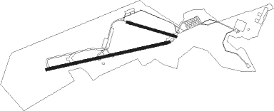
Runway 08 / 26  | ||
| length | 2995m (9826ft) | |
| bearing | 84° / 264° | |
| width | 60m (197ft) | |
| surface | asphalt | |
| blast zone | 255m (837ft) / 0m (0ft) | |
| Runway 11 / 29 | ||
| length | 1210m (3970ft) | |
| bearing | 107° / 287° | |
| width | 50m (164ft) | |
| surface | concrete | |
Nearby beacons
| code | identifier | dist | bearing | frequency |
|---|---|---|---|---|
| BIZ | BIZERTE VOR/DME | 3 | 261° | 114.20 |
| TS | RAOUAD NDB | 27.3 | 126° | 325 |
| TUC | TUNIS VOR/DME | 30.6 | 135° | 116.50 |
| TBK | TABARKA VOR/DME | 48 | 254° | 113.30 |
| TK | TABARKA NDB | 48.3 | 254° | 350 |
Disclaimer
The information on this website is not for real aviation. Use this data with the X-Plane flight simulator only! Data taken with kind consent from X-Plane 12 source code and data files. Content is subject to change without notice.