Placitas - Hatch Muni
Airport details
| Country | United States of America |
| State | New Mexico |
| Region | K2 |
| Airspace | Albuquerque Ctr |
| Municipality | Doña Ana County |
| Elevation | 4080ft (1244m) |
| Timezone | GMT -7 |
| Coordinates | 32.66106, -107.19794 |
| Magnetic var | |
| Type | land |
| Available since | X-Plane v10.40 |
| ICAO code | E05 |
| IATA code | n/a |
| FAA code | E05 |
Communication
| Hatch Muni CTAF | 122.900 |
Nearby Points of Interest:
Rio Grande Bridge at Radium Springs
-Hillsboro High School
-George Tambling Miller and Ninette Stocker Miller House
-Will M. Robins House
-Dona Ana Village Historic District
-Carrie Tingley Hospital Historic District
-Hot Springs Bathhouse and Commercial Historic District in Truth or Consequences
-Elephant Butte Historic District
-Alameda-Depot Historic District
-Thomas Branigan Memorial Library
-Rio Grande Theatre
-Mesilla Plaza
-Hadley-Ludwick House
-Mesilla Park Elementary School
-Mesilla Park Historic District
-Nason House
-Goddard Hall
-Foster Hall
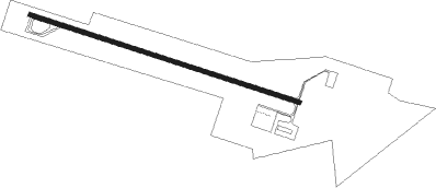
Runway info
| Runway 11 / 29 | ||
| length | 1252m (4108ft) | |
| bearing | 109° / 289° | |
| width | 18m (60ft) | |
| surface | asphalt | |
Nearby beacons
| code | identifier | dist | bearing | frequency |
|---|---|---|---|---|
| DMN | DEMING VORTAC | 31 | 227° | 108.60 |
| TCS | TRUTH OR CONSEQUENCES VORTAC | 37.5 | 352° | 112.70 |
| SV | COZEY (SILVER CITY) NDB | 43.7 | 268° | 251 |
| SVC | SILVER CITY VOR/DME | 48.7 | 269° | 110.80 |
| CUS | COLUMBUS VOR/DME | 54 | 204° | 111.20 |
| EWM | NEWMAN VORTAC | 63.4 | 127° | 112.40 |
| EL | VALTR (EL PASO) NDB | 65.6 | 132° | 242 |
| ELP | EL PASO VORTAC | 68.8 | 133° | 115.20 |
Disclaimer
The information on this website is not for real aviation. Use this data with the X-Plane flight simulator only! Data taken with kind consent from X-Plane 12 source code and data files. Content is subject to change without notice.