San Martin
Airport details
| Country | United States of America |
| State | California |
| Region | K2 |
| Airspace | Oakland Ctr |
| Municipality | San Martin |
| Elevation | 279ft (85m) |
| Timezone | GMT -8 |
| Coordinates | 37.08158, -121.59680 |
| Magnetic var | |
| Type | land |
| Available since | X-Plane v10.40 |
| ICAO code | E16 |
| IATA code | n/a |
| FAA code | n/a |
Communication
| San Martin AWOS | 118.350 |
| San Martin CTAF/UNICOM | 122.700 |
| San Martin NORCAL Approach/Departure | 124.525 |
| San Martin NORCAL Approach/Departure | 120.100 |
Nearby Points of Interest:
Edgar Holloway House
-Gilroy Free Library
-Frank Norris Cabin
-California State Route 152
-Godfrey M. Bockius House
-New Almaden
-Porter-Vallejo Mansion
-Castro Adobe
-Redman Hirahara Farmstead
-Rozas House
-Hayes Mansion
-Grant Ranch County Park
-Hollister Carnegie Library
-Downtown Hollister Historic District
-Pacheco Pass
-Venetian Court
-Elkhorn Slough
-Yung See San Fong House
-Ashworth-Remillard House
-Galindo-Leigh House
-Ross House
-Capt. James A. Hamilton House
-Glen Canyon Covered Bridge
-Dohrmann Building
-Twohy Building
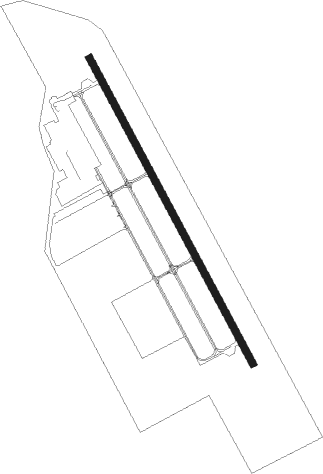
Runway info
| Runway 14 / 32 | ||
| length | 1091m (3579ft) | |
| bearing | 151° / 331° | |
| width | 23m (75ft) | |
| surface | asphalt | |
| displ threshold | 73m (240ft) / 72m (236ft) | |
Nearby beacons
| code | identifier | dist | bearing | frequency |
|---|---|---|---|---|
| SJC | SAN JOSE VOR/DME | 24.2 | 310° | 114.10 |
| SNS | SALINAS VORTAC | 25 | 181° | 117.30 |
| NUQ | MOFFETT (MOUNTAIN VIEW) TACAN | 30.4 | 307° | 117.60 |
| MR | MUNSO (MONTEREY) NDB | 32.1 | 217° | 385 |
| UAD | CHUALAR (SALINAS) NDB | 35.9 | 168° | 263 |
| LV | REIGA (LIVERMORE) NDB | 36.9 | 352° | 374 |
| OSI | WOODSIDE VOR/DME | 37.6 | 294° | 113.90 |
| MOD | MODESTO VOR/DME | 44.7 | 49° | 114.60 |
| PXN | PANOCHE VORTAC | 45 | 114° | 112.60 |
| OAK | OAKLAND VOR/DME | 48.9 | 316° | 116.80 |
| SFO | SAN FRANCISCO VOR/DME | 49.1 | 305° | 115.80 |
| BSR | BIG SUR VORTAC | 54.1 | 183° | 114 |
| CCR | CONCORD VOR/DME | 61.6 | 335° | 117 |
| SAU | SAUSALITO VOR/DME | 64 | 310° | 116.20 |
| LIN | LINDEN VOR/DME | 65.9 | 31° | 114.80 |
Instrument approach procedures
| runway | airway (heading) | route (dist, bearing) |
|---|---|---|
| RW32 | SNS (1°) | SNS HUXUM (8mi, 1°) 5600ft ACETY (9mi, 33°) 3500ft |
| RW32 | ULENY (314°) | ULENY ACETY (8mi, 296°) 3500ft |
| RNAV | ACETY 3500ft GELVY (5mi, 331°) 2100ft E16 (4mi, 331°) 313ft (6889mi, 107°) 1700ft ACETY (6888mi, 287°) 3500ft ACETY (turn) |
Disclaimer
The information on this website is not for real aviation. Use this data with the X-Plane flight simulator only! Data taken with kind consent from X-Plane 12 source code and data files. Content is subject to change without notice.