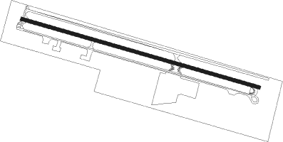
Groveland - Pine Mountain Lake
Airport details
| Country | United States of America |
| State | California |
| Region | K2 |
| Airspace | Oakland Ctr |
| Municipality | Tuolumne County |
| Elevation | 2930ft (893m) |
| Timezone | GMT -8 |
| Coordinates | 37.86167, -120.17856 |
| Magnetic var | |
| Type | land |
| Available since | X-Plane v10.40 |
| ICAO code | E45 |
| IATA code | n/a |
| FAA code | n/a |
Communication
| Pine Mountain Lake CTAF | 122.900 |
Nearby Points of Interest:
Bower Cave
-Track Bus No. 19
-Columbia State Historic Park
-Frog Creek Cabin
-Great Sierra Wagon Road
-Old Adobe Barn
-Old La Grange Schoolhouse
-Odd Fellows Hall
-Douglas Flat School
-Murphys Grammar School
-Sam Choy Brick Store
-Angels Camp
-Calaveras County Bank
-Utica Mansion
-El Portal Old Schoolhouse
-Hornitos Masonic Hall No. 98
-Bagby Stationhouse, Water Tanks and Turntable
-McCauley and Meyer Barns
-Copperopolis Armory
-Reed's Store
-Honigsberger Store
-Copperopolis Congregational Church
-Pohono Bridge
-Yosemite Valley
-El Capitan Bridge
Nearby beacons
| code | identifier | dist | bearing | frequency |
|---|---|---|---|---|
| MOD | MODESTO VOR/DME | 39.5 | 253° | 114.60 |
| HYP | EL NIDO (MERCED) VOR/DME | 39.9 | 199° | 114.20 |
| LIN | LINDEN VOR/DME | 41.1 | 284° | 114.80 |
| FRA | FRIANT VORTAC | 53.2 | 142° | 115.60 |
| HNW | HANGTOWN (PLACERVILLE) VOR/DME | 58.3 | 327° | 115.50 |
| CZQ | CLOVIS (FRESNO) VORTAC | 61.2 | 160° | 112.90 |
Instrument approach procedures
| runway | airway (heading) | route (dist, bearing) |
|---|---|---|
| RW09 | HOFED (72°) | HOFED UPCIM (9mi, 24°) 4500ft |
| RW09 | HONEZ (82°) | HONEZ UPCIM (18mi, 68°) 4500ft |
| RNAV | UPCIM 4500ft PIYHE (5mi, 106°) 4500ft JISAV (4mi, 106°) 3366ft (6811mi, 107°) 3366ft HOFED (6823mi, 287°) 7000ft HOFED (turn) 7000ft |
Disclaimer
The information on this website is not for real aviation. Use this data with the X-Plane flight simulator only! Data taken with kind consent from X-Plane 12 source code and data files. Content is subject to change without notice.
