Seguin - Huber Airpark Civic Club
Airport details
| Country | United States of America |
| State | Texas |
| Region | |
| Airspace | Houston Oceanic Ctr |
| Municipality | Seguin |
| Elevation | 556ft (169m) |
| Timezone | GMT -6 |
| Coordinates | 29.60713, -97.99060 |
| Magnetic var | |
| Type | land |
| Available since | X-Plane v10.40 |
| ICAO code | E70 |
| IATA code | n/a |
| FAA code | E70 |
Communication
| Huber Airpark Civic Club ATIS | 119.325 |
| Huber Airpark Civic Club CTAF/UNICOM | 122.900 |
Nearby Points of Interest:
Lindheimer House
-Carl W. A. Groos House
-Comal County Courthouse
-Comal Power Plant
-Gruene Family Home
-Gruene Historic District
-State Highway 3-A Bridge at Cibolo Creek
-Randolph Field Historic District
-Administration Building
-Farmers Union Gin Company
-Old Main
-M. A. Withers House
-Caldwell County Courthouse Historic District
-Katherine Anne Porter House
-San Antonio Military Medical Center
-Winters-Wimberley House
-Fort Sam Houston
-Fence at Alamo Cement Company
-Monastery of Our Lady of Charity
-Johann and Anna Heidgen House
-Hipolito F. Garcia Federal Building and United States Courthouse
-Alamo Plaza Historic District
-David J. and May Bock Woodward House
-Aurora Apartment Hotel
-Otto Bombach House
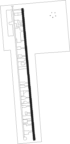
Runway info
| Runway 16 / 34 | ||
| length | 1042m (3419ft) | |
| bearing | 179° / 359° | |
| width | 15m (50ft) | |
| surface | asphalt | |
Nearby beacons
| code | identifier | dist | bearing | frequency |
|---|---|---|---|---|
| DHK | RANDOLPH TACAN | 15 | 256° | 109.90 |
| RND | RANDOLPH VORTAC | 16.2 | 253° | 112.30 |
| RU | GARYS (AUSTIN) NDB | 21.2 | 7° | 272 |
| SAT | SAN ANTONIO VORTAC | 24.6 | 274° | 116.80 |
| AN | ALAMO (SAN ANTONIO) NDB | 30.2 | 270° | 368 |
| SSF | STINSON (SAN ANTONIO) VOR | 31.6 | 232° | 108.40 |
| KSY | KELLY (SAN ANTONIO) TACAN | 33.4 | 250° | 112 |
| STV | STONEWALL VORTAC | 51.7 | 310° | 113.80 |
| CWK | CENTEX VORTAC | 52.1 | 31° | 112.80 |
| HHH | DEVINE NDB | 57 | 244° | 359 |
Disclaimer
The information on this website is not for real aviation. Use this data with the X-Plane flight simulator only! Data taken with kind consent from X-Plane 12 source code and data files. Content is subject to change without notice.