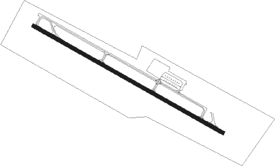
San Manuel
Airport details
| Country | United States of America |
| State | Arizona |
| Region | K2 |
| Airspace | Albuquerque Ctr |
| Municipality | Pinal County |
| Elevation | 3272ft (997m) |
| Timezone | GMT -7 |
| Coordinates | 32.63644, -110.64729 |
| Magnetic var | |
| Type | land |
| Available since | X-Plane v10.40 |
| ICAO code | E77 |
| IATA code | n/a |
| FAA code | n/a |
Communication
| San Manuel CTAF | 122.900 |
Nearby Points of Interest:
La Casa del High Jinks
-Lemmon Rock Lookout House
-Lowell Ranger Station
-DeGrazia Gallery in the Sun Historic District
-San Pedro Chapel
-St. Philip's in the Hills Episcopal Church
-Manning Cabin
-Catalina American Baptist Church
-Colonia Solana Residential Historic District
-USDA Tucson Plant Materials Center
-University of Arizona Campus Historic District
-Miracle Mile Historic District
-Coronado Hotel
-Stone Avenue Underpass
-Julian-Drew Building
-Fox Commercial Building
-J. C. Penney–Chicago Store Building
-James A. Walsh United States Courthouse
-Pima County Courthouse
-Valley National Bank Building
-Sosa-Carrillo-Fremont House
-El Paso and Southwestern Railroad Depot
-El Tiradito
-Barrio El Membrillo Historic District
-Barrio Santa Rosa
Nearby beacons
| code | identifier | dist | bearing | frequency |
|---|---|---|---|---|
| DMA | DAVIS-MONTHAN (TUCSON) TACAN | 30.9 | 206° | 117.60 |
| AVQ | MARANA NDB | 31.7 | 248° | 245 |
| TUS | TUCSON VORTAC | 35.2 | 206° | 116 |
| RYN | RYAN (TUCSON) NDB | 39.6 | 226° | 338 |
| RBJ | ROBLES (TUCSON) NDB | 49.4 | 232° | 220 |
Disclaimer
The information on this website is not for real aviation. Use this data with the X-Plane flight simulator only! Data taken with kind consent from X-Plane 12 source code and data files. Content is subject to change without notice.
