Cerfontaine
Airport details
| Country | Belgium |
| State | Namur |
| Region | EB |
| Airspace | Brussels Ctr |
| Municipality | Cerfontaine |
| Elevation | 955ft (291m) |
| Timezone | GMT +1 |
| Coordinates | 50.15278, 4.38722 |
| Magnetic var | |
| Type | land |
| Available since | X-Plane v10.40 |
| ICAO code | EBCF |
| IATA code | n/a |
| FAA code | n/a |
Communication
| Cerfontaine Cerfontaine Radio | 123.205 |
Nearby Points of Interest:
Lompret
-Roly
-Fosteau Castle
-Kanzel
-Hanging Gardens of Thuin
-Chapelle Sainte-Hiltrude de Liessies
-Cité de l'Enfance
-Christ en croix de Marpent
-City walls of Rocroi
-Amicale Solvay
-Résidence Albert
-Montignies-sur-Sambre - Chapelle du Calvaire
-Immeuble De Heug
-Passage de la Bourse (Charleroi)
-Brasserie des Alliés
-Hôtel des Postes
-Maison Dermine
-église Saint-Georges de Fumay
-Maison Dorée (Charleroi)
-Maison du Bailli
-Charleroi City Hall
-Maison La Fleur (Charleroi)
-Cité Paris-Campagne
-Maison des médecins
-Maison Bertinchamps (Charleroi)
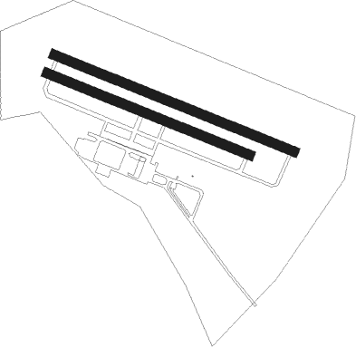
Runway info
Runway 12L / 30R  | ||
| length | 801m (2628ft) | |
| bearing | 108° / 288° | |
| width | 30m (98ft) | |
| surface | grass | |
| blast zone | 31m (102ft) / 107m (351ft) | |
| Runway 12R / 30L | ||
| length | 676m (2218ft) | |
| bearing | 108° / 288° | |
| width | 30m (98ft) | |
| surface | grass | |
| displ threshold | 0m (0ft) / 135m (443ft) | |
| blast zone | 29m (95ft) / 109m (358ft) | |
Nearby beacons
| code | identifier | dist | bearing | frequency |
|---|---|---|---|---|
| BFS | FLORENNES TACAN | 11.5 | 72° | 111.50 |
| GSY | GOSLY (CHARLEROI) VOR/DME | 18.2 | 10° | 115.70 |
| ONC | CHARLEROI NDB | 21.2 | 27° | 323 |
| CIV | CHIEVRES VORTAC | 33 | 307° | 113.20 |
| HUL | HULDENBERG VOR/DME | 37.1 | 23° | 117.55 |
| HTB | BEAUVECHAIN NDB | 39 | 32° | 381 |
| BBE | BEAUVECHAIN TACAN | 39.1 | 32° | 116 |
| OZ | BRUSSELS NATIONAL NDB | 40.5 | 7° | 314 |
| BUB | BRUSSELS VOR/DME | 45.3 | 11° | 114.60 |
| AFI | AFFLIGEM VOR/DME | 46.3 | 342° | 114.90 |
| OB | BRUSSELS NDB | 46.9 | 17° | 293 |
| OP | BRUSSELS NATIONAL NDB | 47.8 | 15° | 402 |
| FLO | FLORA VOR/DME | 52 | 46° | 112.05 |
| REM | REIMS VOR | 52.2 | 202° | 112.30 |
| MMD | MONTMEDY VOR | 53.9 | 136° | 109.40 |
| MAK | MACKEL NDB | 59.4 | 312° | 360 |
| BUN | BRUNO VOR/DME | 60.5 | 25° | 110.60 |
Disclaimer
The information on this website is not for real aviation. Use this data with the X-Plane flight simulator only! Data taken with kind consent from X-Plane 12 source code and data files. Content is subject to change without notice.