Vresse En Semois - Vresse Sur Semois / Orchimont
Airport details
| Country | Belgium |
| State | Namur |
| Region | EB |
| Airspace | Brussels Ctr |
| Municipality | Vresse-sur-Semois |
| Elevation | 1312ft (400m) |
| Timezone | GMT +1 |
| Coordinates | 49.90722, 4.93639 |
| Magnetic var | |
| Type | land |
| Available since | X-Plane v10.40 |
| ICAO code | EBOR |
| IATA code | n/a |
| FAA code | n/a |
Communication
Nearby Points of Interest:
Tombeau du Géant
-Porcheresse Castle
-Château Marcadet
-église Saint-Georges de Fumay
-Forge de Vrigne-aux-Bois
-Cité jardin Faure
-Bains-douches de Charleville-Mézières
-Château de Lumes
-Cité Paris-Campagne
-Town hall (Charleville-Mézières)
-Enceinte de Mézières
-La Macérienne
-Château-Bas de Sedan
-Couvent des Capucins irlandais
-Hôtel de ville de Sedan
-Manufacture de draps Cunin-Gridaine
-Château de Montvillers
-Maison Gambier
-Manège militaire de Givet
-Couvent des Récollectines de Givet
-Cellatex
-Anticline of the Cluse du Ry d'Ave
-City walls of Rocroi
-Bornes de Saint-Rémi
-Fortifications de Carignan
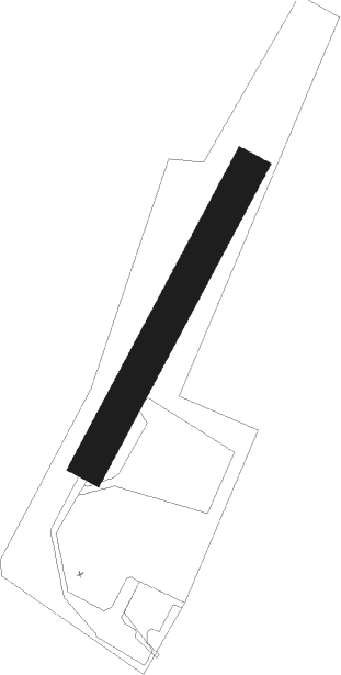
Runway info
| Runway 03 / 21 | ||
| length | 277m (909ft) | |
| bearing | 45° / 225° | |
| width | 30m (98ft) | |
| surface | grass | |
| displ threshold | 0m (0ft) / 1m (3ft) | |
Nearby beacons
| code | identifier | dist | bearing | frequency |
|---|---|---|---|---|
| BFS | FLORENNES TACAN | 22.8 | 320° | 111.50 |
| MMD | MONTMEDY VOR | 31.8 | 160° | 109.40 |
| GSY | GOSLY (CHARLEROI) VOR/DME | 37.9 | 318° | 115.70 |
| ONC | CHARLEROI NDB | 37.9 | 327° | 323 |
| SPI | SPRIMONT VOR/DME | 45 | 49° | 113.10 |
| LGE | LIEGE VOR/DME | 49.3 | 36° | 115.45 |
| ETN | ETAIN NDB | 49.8 | 133° | 410 |
| REM | REIMS VOR | 49.8 | 236° | 112.30 |
| LNO | OLNO VOR/DME | 50.4 | 49° | 112.80 |
| SLV | SPA NDB | 50.8 | 60° | 386 |
| HTB | BEAUVECHAIN NDB | 51.3 | 349° | 381 |
| BBE | BEAUVECHAIN TACAN | 51.4 | 349° | 116 |
| HUL | HULDENBERG VOR/DME | 51.8 | 341° | 117.55 |
| ONL | LIEGE NDB | 53.1 | 38° | 290 |
| OZ | BRUSSELS NATIONAL NDB | 58 | 333° | 314 |
| FLO | FLORA VOR/DME | 58.7 | 12° | 112.05 |
| BUB | BRUSSELS VOR/DME | 61.6 | 338° | 114.60 |
Disclaimer
The information on this website is not for real aviation. Use this data with the X-Plane flight simulator only! Data taken with kind consent from X-Plane 12 source code and data files. Content is subject to change without notice.